Добрый день, Коллеги. Важное сообщение, просьба принять участие. Музей Ферсмана ищет помощь для реставрационных работ в помещении. Подробности по ссылке

Поиск по книгам
Издание:PGS Publishing, Linden Park, 2005 г., 24 стр.
Язык(и)Английский
Chuquicamata, Core of a Planetary Scale Cu-Mo Anomaly

The copper and molybdenum mineralisation of the Chuquicamata deposit has been known since the 19' century. The deposit is located within the Codelco Norte District in the Andes Ranges of northern Chile, 200 km northeast of the city of Antofagasta. Small miners initially worked the exposed oxidised outcrops and high grade oxide veins that were the surface expression of the deposit, although industrial scale mining did not commence until 1915 with open pit exploitation of the main disseminated oxides. Mining has continued to the present day, currently removing approximately 170 000 tonnes of ore and 400 000 tonnes of waste per day.

Издание:Canadian Institute of Mining Metallurgy and Petroleum, 2014 г., 10 стр.
Язык(и)Английский
CIM Definition Standards for Mineral Resources & Mineral Reserves / Стандарты определения CIM для минеральных ресурсов и запасов полезных ископаемых

The CIM Definition Standards on Mineral Resources and Reserves (CIM Definition Standards) establish definitions and guidance on the definitions for Mineral Resources, Mineral Reserves, and mining studies used in Canada. The Mineral Resource, Mineral Reserve, and mining study definitions are incorporated, by reference, into National Instrument 43-101 – Standards of Disclosure for Mineral Projects (NI 43-101). The CIM Definition Standards can be viewed at mrmr.cim.org.

Издание:The Canadian Institute of Mining, 2019 г., 74 стр.
Язык(и)Английский
CIM Estimation of mineral resources and mineral reserves best practice guidelines / Рекомендации по наилучшей практике оценки минеральных ресурсов и запасов полезных ископаемых CIM

The CIM Estimation of Mineral Resources and Mineral Reserves Best Practice Guidelines (MRMR Best Practice Guidelines) were prepared by the Canadian Institute of Mining, Metallurgy and Petroleum's (CIM) Mineral Resources and Mineral Reserves Committee (CIM MRMR Committee) to update an earlier version that was accepted by CIM Council on November 23, 2003 (CIM, 2003). These 2019 MRMR Best Practice Guidelines supersede and replace the November 23, 2003 version of the MRMR Guidelines <...>

Автор(ы):Legget R.F.
Издание:McGraw-Hill Book Company, 1973 г., 627 стр., ISBN: 0-07-037062-1
Язык(и)Английский
Cities and geology / Города и геология

The purpose of this book is to show how essential is geology in the planning and development of cities. Town and country planning is now accepted throughout the world as a vital public service, in place of the unorganized and uncontrolled use of land in earlier days. All such planning involves the optimum use of land so that the physical development of cities and regions may best meet the needs of people. The proper use of land—for buildings, for roads, for parks—can be achieved only if the nature of the ground and subsurface conditions is known with certainty. Since the science of geology is concerned with all aspects of the crust of the earth, the use of geological information, and of geological methods to obtain new information about local subsurface conditions, should therefore be an essential part of the physical planning of all cities. <...>

Редактор(ы):Moores E.M., Sloan D., Stout D.L.
Издание:Geology Society of America, 1999 г., 503 стр., ISBN: 0-8137-2338-8
Язык(и)Английский
Classic Cordilleran concepts: a view from California / Классическая теория в Кордильерах: взгляд из Калифорнии

Looking back over a century of geoscience research in the Cordillera is both an inspiring and a humbling exercise. So much has been learned that could not have been imagined in 1899! Other contributions to this volume discuss some of the classic papers in various fields that have led the way to fundamental new insights. In this opening chapter, I prefer to highlight the largely unsung but crucial contributions to the overall research effort that have been made by thousands of faces in the crowd laboring steadily outside the limelight to advance our understanding of Cordilleran geoscience. It is easy to forget that the pacesetting perceptions of the giants among us would be impossible without the information gained, day to day, by uncelebrated colleagues who work assiduously, by their own best lights, to dispel the scientific darkness bit by bit. In our admiration for intellectual leaders, we should always remember that science is the most supremely collegial and collaborative of all human endeavors. They also make their marks who never win an award, but must be content with the plaudits of their own consciences. <...>

Издание 2
Автор(ы):Morita O.
Издание:CRC Press, 2019 г., 392 стр., ISBN: 978-1-032-31503-4
Язык(и)Английский
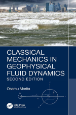
Classical mechanics in geophysical fluid dynamics / Классическая механика в геофизической гидродинамике

In this chapter, minimal prerequisites not only for classical mechanics but also for physics, in general, are introduced. Physical dimensions, SI base units, SIderived units, and significant figures are discussed. Four coordinate systems, Cartesian coordinates, plane polar coordinates, cylindrical coordinates, and spherical coordinates are concisely shown. The coordinate transformation, which will be used in later chapters, is discussed. A Taylor series expansion is often used in physics, so that it is precisely explained. <...>

Издание:Canadian Institute of Mining Metallurgy and Petroleum, 2003 г., 19 стр.
Язык(и)Английский
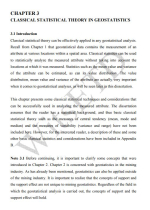
Classification and reporting of mineral resources for high-nugget effect gold vein deposits / Классификация и отчетность о минеральных ресурсах золото-кварцевых (жильных) месторождений с значительным влиянием эффекта самородка

The often complex, erratic, and localized nature of gold is a common feature of many vein-style gold deposits. This style of mineralization is often referred to as being nuggety or possessing a high-nugget effect. As a result of these complexities resource estimation is difficult and in general, only Exploration Results can be provided or an Inferred Mineral Resource estimated from surface drilling data alone. Underground development, further drilling, and probably bulk sampling will be required to delineate Indicated and Measured Resources.

Издание 2
Автор(ы):Mather P.M., Tso B.
Издание:Taylor & Francis Group, 2009 г., 356 стр., ISBN: 978-1-4200-9072-7
Язык(и)Английский
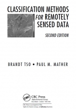
Classification methods for remotely sensed data / Методы классификации данных дистанционного зондирования

Remotely sensed image data is widely used in a range of oceanographic, terrestrial, and atmospheric applications, such as land-cover mapping, environmental modeling and monitoring, and the updating of geographical databases. Hence, the quantized pixel values making up an image may be converted to physical values of radiance and related to some property of the surface being sensed. An example of this approach is the calibration of thermal infrared imagery to produce maps of temperature fields, such as sea surface temperature.

Автор(ы):Stephenson P.R., Stoker P.T.
Издание:2001 г., 6 стр.
Язык(и)Английский
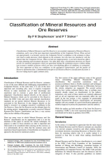
Classification of mineral resources and ore reserves / Классификация минеральных ресурсов и рудных запасов

Classification of Mineral Resources and Ore Reserves is an essential component of Resource/Reserve estimation, and is one of the most important responsibilities of the Competent Person. When carried out appropriately, it accurately conveys the Competent Person’s confidence in the estimates to those who need to make decisions which depend on the estimates, but who have less familiarity with the deposit than the Competent Person.

1419.41