Поиск по книгам
Том 2
Редактор(ы):Сумбатов Р.А.
Издание:Наука, Москва, 1984 г., 115 стр., УДК: 553.93/98.042:620.91 (100)
Язык(и)Русский
27-й международный геологический конгресс. Энергетические ресурсы мира. Коллоквиум 2. Доклады. Том 2

В сборнике рассмотрены мировые ресурсы нефти, газа, горючих сланцев и угля. Проанализированы геологические закономерности их пространственного размещения. Предложены новые методы поисков и разведки основных видов энергетического сырья

Редактор(ы):Гришина Т.Б.
Издание:Наука, Москва, 1989 г., 264 стр., УДК: 552.2:552.11, ISBN: 5-02-003176-3
Язык(и)Русский
28-й Международный геологический конгресс. Доклады советских геологов. Кристаллическая кора в пространстве и времени. Магматизм

Добрецов Н.Л., Ащепков И.В., Ионов ДА. Эволюция верхней мантии и базальтового магматизма Байкальской рифтовой зоны
Золотарев Б.П., Пейве А.А., Пущаровский Ю.М. Вещественная и структурная неоднородности во втором слое океанической коры
Жариков В.А., Гаврикова С.Н. О двух механизмах гранитообразования
Белоусов В.В. Эндогенные режимы: взаимодействие верхней мантии и коры
Маракушев А.А. Вулкано-плутонические ассоциации офиолитовых формаций
Дымкин А.М., Полтавец Ю.А. Петро-геохимические особенности железоносных вулкано-плутонических ассоциаций Урала
Поляков Г.В., Балыкин П.А. Генетическая модель формирования расслоенных ультрабазит-базитовых массивов Байкало-Становой области

Автор(ы):Bacon M., Redshaw T., Simm R.
Издание:Cambridge University Press, 2003 г., 206 стр., ISBN: 0-521-79203-7
Язык(и)Английский
3-D Seismic interpretation / Интерпретация 3-D сейсморазведки

3-D seismic data have become the key tool used in the oil and gas industry to understand the subsurface. In addition to providing excellent structural images, the dense sampling of a 3-D survey can sometimes make it possible to map reservoir quality and the distribution of oil and gas. The aim of this book is to help geophysicists and geologists new to the technique to interpret 3-D data while avoiding common pitfalls.

Автор(ы):Vermeer G.J.O.
Редактор(ы):Beasley C.J.
Издание:Society of exploration geophysicists, 2002 г., 209 стр., ISBN: 1-56080-113-1
Язык(и)Английский
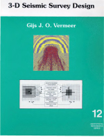
3-D seismic survey design / Проект трехмерной сейсморазведки

Since the first edition of 3D Seismic Survey Design appeared in 2002, seismic data acquisition has seen many changes, most of which have been captured in this second edition. This book by Gijs Vermeer describes in detail the properties of 3D acquisition geometries and shows how these properties naturally lead to the 3D symmetric sampling approach to 3D survey design. Many examples from the literature are used to illustrate good and less good choices of acquisition parameters. The link between survey parameters and noise suppression as well as imaging is an intrinsic part of the contents. This book should be of great interest to the designer of 3D seismic surveys, but also to every geophysicist who uses 3D seismic data to retrieve accurate information on the properties of the subsurface. <...>

Издание 2
Автор(ы):Groshong R.H.
Издание:Springer, New York, 2006 г., 410 стр., ISBN: 3-540-065422-4
Язык(и)Английский
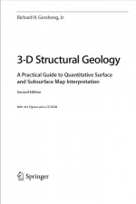
3-D Structural Geology. A practical guide to quantitative surface and subsurface map interpretation /  3-D Структурная геология. Практическое руководство по количественной интерпретации карты поверхности и недр

Geological structures are three dimensional, yet are typically represented by, and interpreted from, outcrop maps and structure contour maps, both of which are curved two-dimensional surfaces. Maps plus serial sections, called 2½-D, provide a closer approach to three dimensionality. Computer technology now makes it possible for geological interpretations to be developed from the beginning in a fully three dimensional environment. Fully 3-D geological models allow significantly better interpretations and interpretations that are much easier to share with other geologists and with the general public. This book provides an overview of techniques for constructing structural interpretations in 2-D, 2½-D and 3-D environments; for interpolating between and extrapolating beyond the control points; and for validating the final interpretation. The underlying philosophy is that structures are three-dimensional solid bodies and that data from throughout the structure, whether in 2-D or 3-D format, should be integrated into an internally consistent 3-D interpretation.

Редактор(ы):Freeman B., Krantz B., Ormand C.
Издание:AAPG, 2016 г., 238 стр., ISBN: 978-0-89181-391-0
Язык(и)Английский
3-D structural interpretation: Earth, mind, and machine / 3-D структурная интерпретация: Земля, разум и машина

Geologists as a group have and use above-average spatial thinking skills to interpret and communicate complex geologic structures. Interpretation challenges, especially with petroleum industry subsurface targets, come from abundant but still ambiguous data volumes, challenging geologic forms, powerful but difficult-to-learn software, and under prepared staff. In June 2013, 70 participants met in Reno to discuss these and related issues and to explore how spatial cognitive science can help us better understand and develop geologic interpretation skills, software tools, and education strategies. Industry interpreters and trainers, academic structural geologists, software developers, and cognitive scientists brought complementary perspectives to three days of presentations, posters, and discussions, plus a field day with interactive interpretation modules. This Hedberg conference provided new shared insights to the interpretation process, ideas for improving skill development, and abundant opportunities for further collaboration. <...>

Редактор(ы):Байкалов С.П., Барышников Г.Я., Березиков Ю.К., Кирюшин Ю.Ф.
Издание:Алтайский государственный университет, Барнаул, 2000 г., 480 стр., УДК: 551.7:553
Язык(и)Русский
300 лет горно-геологической службе России: история горнорудного дела, геологическое строение и полезные ископаемые Алтая

Материалы сборника посвящены истории становления горнорудного дела и освоению рудных богатств Алтая, проблемам совеременной геологии, развитию минерально-сырьевой базы региона, решению сложных задач геоэкологии и определениюперпсектив по использованию минеральных ресурсов. 

Редактор(ы):Bistacchi A., Massironi M., Viseur S.
Издание:Wiley, 2022 г., 222 стр., ISBN: 9781119313885
Язык(и)Английский
3D digital geological models. From terrestrial outcrops to planetary surfaces / 3D цифровые модели. От естественных обнажений до планетарных поверхностей

Collecting quantitative data to support geological analysis and modelling is nowadays a fundamental requirement in all geology disciplines, including structural geology, stratigraphy, and geomorphology, on the Earth and on planetary bodies of the Solar System. In many cases the answer to this need is a Digital Outcrop Model (DOM), a Digital Elevation Model  (DEM), or a Shape Model (SM): this can be a digital representation of an outcrop or topographic surface, or of a whole small body (asteroid or comet nucleus) for an SM, generally combined with imagery, that can be quantitatively visualized andstudied in 3D, with the goal of obtaining quantitative measurements.

Автор(ы):Cameron R., Horvath J.
Издание:MatterHacker apress, 2017 г., 245 стр., ISBN: 978-1-4842-2694-0
Язык(и)Английский
3D printed science projects. Volume 2. Physics, math, engineering and geology models / Научные проекты на 3D принтере. Часть 2. Физические, математические, инженерные и геологические модели

This chapter looks at the deceptively simple world of pendulums. First we cover why pendulums swing back and forth as they do, and tie this into the general idea of simple harmonic motion—a type of oscillatory motion in which a system stores energy (in a spring or by working against gravity) and then uses that stored energy to move back to its original position.

Автор(ы):Biondi B.L
Издание:Society of exploration geophysicists, Tulsa, 2006 г., 245 стр., ISBN: 0-931830-46-X
Язык(и)Английский
3D Seismic Imaging / Трехмерная сейсмическая съемка

In the past decade, 3D reflection seismology has replaced 2D seismology almost entirely in the seismic industry. Recording 3D surveys has become the norm instead of the exception. The application of 2D seismology is limited mostly to reconnaissance surveys or to locations where recording 3D data is still prohibitively expensive, such as in rough mountains and wild forests. However, academic research and teaching have struggled to keep up with the 3D revolution. As a consequence of this tardiness, no books are available that introduce the theory of seismic imaging from the 3D perspective. This book is aimed at filling the gap.

1520.9