Добрый день, Коллеги. Важное сообщение, просьба принять участие. Музей Ферсмана ищет помощь для реставрационных работ в помещении. Подробности по ссылке
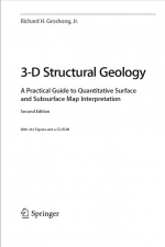
3-D Structural Geology. A practical guide to quantitative surface and subsurface map interpretation / 3-D Структурная геология. Практическое руководство по количественной интерпретации карты поверхности и недр
Geological structures are three dimensional, yet are typically represented by, and interpreted from, outcrop maps and structure contour maps, both of which are curved two-dimensional surfaces. Maps plus serial sections, called 2½-D, provide a closer approach to three dimensionality. Computer technology now makes it possible for geological interpretations to be developed from the beginning in a fully three dimensional environment. Fully 3-D geological models allow significantly better interpretations and interpretations that are much easier to share with other geologists and with the general public. This book provides an overview of techniques for constructing structural interpretations in 2-D, 2½-D and 3-D environments; for interpolating between and extrapolating beyond the control points; and for validating the final interpretation. The underlying philosophy is that structures are three-dimensional solid bodies and that data from throughout the structure, whether in 2-D or 3-D format, should be integrated into an internally consistent 3-D interpretation.
It is assumed that most users of this book will do their work on a computer. Consequently, the book provides quantitative structural methods and techniques that are designed for use with spreadsheets, mapping software, and three-dimensional computer-graphics programs. The book is also intended to provide the background for understanding what interpretive software, for example, a computer contouring program, does automatically. Most techniques are presented in both a traditional format appropriate for paper, pencil, and a pocket calculator, and in quantitative format for use with spreadsheets and computer-graphics or computer-aided-design programs.
The methods are designed for interpretations based on outcrop measurements and subsurface information of the type derived primarily from well logs and two-dimensional seismic reflection profiles. These data sets all present a similar interpretive problem, which is to define the complete geometry from isolated and discontinuous observations. The techniques are drawn from the methods of both surface and subsurface geology and provide a single methodology appropriate for both. The focus is on the interpretation of layered sediments and rocks for which bedding surfaces provide reference horizons


