Добрый день, Коллеги. Важное сообщение, просьба принять участие. Музей Ферсмана ищет помощь для реставрационных работ в помещении. Подробности по ссылке
Таблицы трехзначных (0,000—1,000) коэффициентов предназначены для определения истинной, вертикальной, горизонтальной или видимой (в заданном направлении) мощности пласта, находящегося в любых пространственных соотношениях с линией исходного замера. Прилагаются номограммы для вычисления мощностей в полевых условиях и определения углов падения пласта пли наклона скважины в косом сечение (плоскости разреза). Описаны способы и примеры пользования таблицами и номограммами. Книга предназначена для широкого круга специалистов.
Доклады советских геологов охватывают широкий круг вопросов. Здесь рассмотрены и общие научные проблемы формирования и разрушения (деструкции) земной коры в ходе геологической истории (В.Е.Хаин, Е.Е.Милановский, В.В.Белоусов, М.В.Муратов и др.), и отдельные, принципиального значения, теоретические вопросы тектоники (С.В. Руженцев, А.А. Белов, Н.Л. Добрецов, В.Н. Пучков, А.Л.Яншин и др.), и наиболее важные проблемы связи полезных ископаемых с тектоникой (Ю.М. Пущаровский, С.Н. Иванов, Н.А.Шило и др.); некоторое освещение получили также вопросы тектоники океанов (А.В. Пейве, Л.И.Красный и др.).
Описаны структурные формы земной коры, их морфология, происхождение и изображение. Приведены сведения об истории структурной геологии и ее основных методах. Учебник предназначен для студентов специальностей 080500 — «Геология нефти и газа», 080400 - «Геофизические методы поисков и разведки месторождений полезных ископаемых» и 080900 — «Геофизические методы исследования скважин», а также направления 663200 — поиски и разведка месторождений полезных ископаемых.
The stereographic projection is an essential tool of geologists and civil engineers which allows threedimensional orientation data to be both represented and manipulated. It provides a way of graphically displaying the data collected which is essential for the recognition and interpretation of patterns of preferred orientation. It allows also the data to be processed, rotated and analysed by means of a number of standard geometrical constructions. The latter can be rapidly carried out using computer software but the stereographic method has the advantage that the constructions can be visually appreciated and shown graphically.
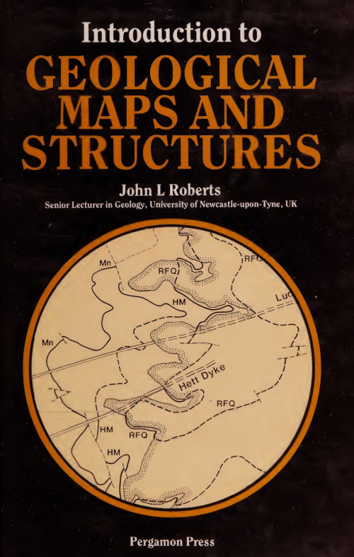
This book is designed primarily for university and college students taking geology as an honours course or as a subsidiary subject. Its aim is to lead the student by easy stages from the simplest ideas on geological structures right through the first year course on geological mapping, and much that it contains should be of use to students of geology at GeE 'A' level. The approach is designed to help the student working with little or no supervision: each new topic is simply explained and illustrated by text-figures, and exercises are set on succeeding problem maps.
The elementary student of geology may well first encounter the basic elements of structural geology through the study and interpretation of geological maps. However, there are few if any textbooks on structural geology which concentrate on showing how the forms of geological structures can be determined from the evidence presented by a geological map, even although such an analysis is fundamental to their interpretation. Admittedly, there are several laboratory manuals on the British market which offer a very elementary introduction to the basic methods used in the interpretation of geological maps.
Documentation of structures in different scales is the first step in many structural geological studies. This edited atlas gives an overview of diverse structures. Due to lack of space or inappropriateness, sometimes interesting structural snaps cannot be published in journals. This book fills that gap.
The Barmer basin in Rajasthan (India) is a narrow, failed, continental rift basin with uplifted rift shoulders exposed along its E and W margins. The basin trends NNW and comprises of thick Mesozoic and Tertiary sediments. Its tectonic evolution is somewhat linked to other Mesozoic and/or Tertiary basins of NW segment of Rajasthan, India. The Barmer basin comprises of thick sedimentary sequence from Jurassic to recent overlying the Malani Igneous Suite. Structural field studies (Dasgupta and Mukherjee, 2017) along the rift margins helped in deciphering the two-phases (NW-SE followed by NE-SW) of extension through brittle shear tectonics. Field studies further identified: (1) structural inheritance of NNW trending fractures of older Malani basement rocks in the NW trending rift faults, (2) role of transfer zones (Dasgupta and Mukherjee 2019, Dasgupta and Maitra 2018, Dasgupta 2018) in rift fault propagation. Near NE trending mega-scale transfer zones have been documented along the Fatehgarh fault trend in N margin of the Barmer basin. See Bladon et al. (2015), Dolson et al. (2015), Dasgupta and Mukherjee (2017), Dasgupta and Mukherjee (2019) and Sharma (2007). for recent understanding on the tectonic of the Barmer region and its surroundings. Vide Passchier and Trouw (2005), Mukherjee (2011a, 2012, 2013, 2015), Mukherjee and Koyi (2010a, b) etc. for shear sense indicators.
Tectonics and structural geology of Indian terrain is of great interest to the Government and a number of private exploration agencies that are working presently. This edited volume aims to meet this requirement. In addition, B.Sc. and M. Sc. geoscience students undergoing geohistory and/or tectonic courses would benefit using this book. This edited volume brings 16 research papers (Chaps. 2–17) from both academia and industry. Mukherjee et al. (2019) in Chap. 2 present an exhaustive review on the geology and the geochronology and of the Chotanagpur Granite Gneissic Complex (CGGC). They classify the CGGC into three domains, and also comment on the India-Antarctica reconstruction. <...>
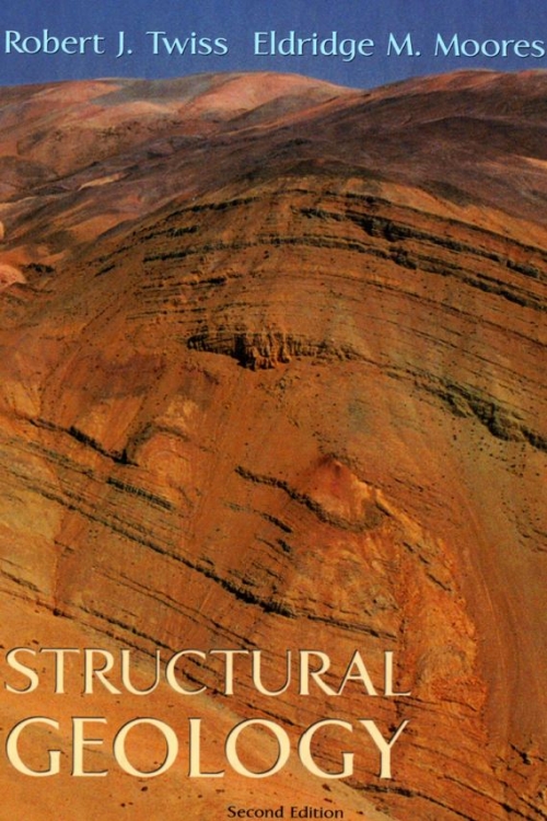
Structural geology and tectonics represent a continuum in the scale at which we study deformation in the Earth, with structural geology concerned largely with the microscopic to regional scales and tectonics concerned largely with the regional to global scales. Studies at the different scales are interdependent, however, and in fact, studies at one scale invariably inform studies at other scales.