Добрый день, Коллеги. Важное сообщение, просьба принять участие. Музей Ферсмана ищет помощь для реставрационных работ в помещении. Подробности по ссылке

Поиск по книгам
Автор(ы):Noppe M.A.
Издание:2004 г., 7 стр.
Язык(и)Английский
Reconciliation: importance of good sampling and data QAQC / Сопоставление: важность надлежащей выборки и контроля качества данных

Mining reconciliation is the comparison of estimated tonnage, grade and metal with actual measurements. The aims are to measure the performance of the operation, support the calculation of the mineral asset, validate the Mineral Resource and Ore Reserve estimates, and provide key performance indicators for short and long-term control (Morley, 2003). Ongoing, regular and efficient reconciliation should also highlight improvement opportunities and allow for proactive short-term forecasting by providing reliable calibrations to critical estimates. The concept is that of “measure, control and improve”.  <...>

Автор(ы):Davidson J., Mpodozis C.
Издание:1991 г., 13 стр.
Язык(и)Английский
Regional geologic setting of epithermal gold deposits, Chile / Региональные геологические условия эпитермальных золоторудных месторождений, Чили

Epithermal gold deposits in Chile are Cretaceous to Cenozoic in age. The ores and the volcanic rocks with which they are associated were generated at a noncollisional, ocean-continent convergent plate margin. They are related to long, slightly sinuous north-northeasttrending magmatic belts roughly parallel to the Pacific coast. Most of the deposits are associated with eroded volcanic centers and subvolcanic porphyries. North-south variations in the nature, extent, and timing of magmatism control the succession of mineralization events. In the Late Cretaceous, vein districts (e.g., E1 Bronce) and hydrothermal alteration zones were formed in central Chile.

Том 1, Издание 2
Редактор(ы):Adam J., Bally A.W., Chiarella D., Roberts D.G., Scarselli N.
Издание:Elsevier, 2020 г., 877 стр., ISBN: 978-0-444-64134-2
Язык(и)Английский
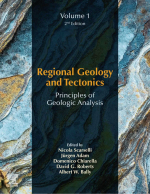
Regional geology and tectonics. Principles of geologic analysis. Volume 1 / Региональная геология и тектоника. Часть 1. Принципы геологического анализа

The most important question every geoscientist should continually ask is ‘why’? Why do I see what I see? Too often it is accepted, for example, that a sedimentary basin ‘is there’, and geoscientists continue to work on surfaces and units within its boundaries, without ever questioning ‘why do I have this hole in the ground’? Why is it here? What governed its geometry and stratigraphic architecture? What controlled the sediment entry points? What dictates the thermal structure? In resource evaluation and field development, the focus is commonly further narrowed, with management only requesting a map on a ‘Green Horizon’ picked on seismic data in a workstation environment covering only a small segment of the total basin area; insights from the broader regional and mega-regional geological understanding are lost. <...>

Редактор(ы):Bally A.W., Roberts D.G.
Издание:Elsevier, 2012 г., 1221 стр., ISBN: 978-0-444-56357-6
Язык(и)Английский
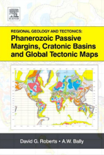
Regional geology and tectonics: Phanerozoic passive margins, cratonic basins and global tectonic maps / Региональная геология и тектоника: Фанерозойские пассивные окраины, кратонные бассейны и глобальные тектонические карты

Both the petroleum industry and academia continue to undergo a transition whereby active knowledge transfer by experienced earth scientists represented by faculty teachers and researchers, Chief geoscientists, etc. is rapidly changing to passive knowledge (or data transfer) through a variety of electronic media and systems. Over the recent past, the broad experience base in both industry and academia has been phased out through retirement, redundancy and focus on specific research areas. In the case of industry, a new generation of younger specialists, sometimes called Nintendo geoscientists, are trained to solve specific practical problems based on highly focussed data acquisition and interpretation using work stations. In academia, an increasingly holistic focus on earth systems science is eroding the broader geological base that has hitherto underpinned scholarly research. <...>

Редактор(ы):Bally A.W., Roberts D.G.
Издание:Elsevier, 2012 г., 544 стр., ISBN: 978-0-444-56356-9
Язык(и)Английский
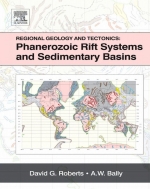
Regional Geology and Tectonics: Phanerozoic Rift Systems and Sedimentary Basins / Региональная геология и тектоника: Фанерозойские рифтовые системы и осадочные бассейны

Both the petroleum industry and academia continue to undergo a transition whereby active knowledge transfer by experienced earth scientists represented by faculty teachers and researchers, Chief geoscientists, etc. is rapidly changing to passive knowledge (or data transfer) through a variety of electronic media and systems. Over the recent past, the broad experience base in both industry and academia has been phased out through retirement, redundancy and focus on specific research areas. In the case of industry, a new generation of younger specialists, sometimes called Nintendo geoscientists, are trained to solve specific practical problems based on highly focussed data acquisition and interpretation using work stations. In academia, an increasingly holistic focus on earth systems science is eroding the broader geological base that has hitherto underpinned scholarly research <...>

Автор(ы):Frazier W.J., Schwimer D.R.
Издание:Plenum press, 1987 г., 734 стр., ISBN: 978-1-4612-9005-6
Язык(и)Английский
Regional stratigraphy of North America / Региональная стратиграфия Северной Америки

Stratigraphy lies at the heart of geology and we have set for ourselves the rather daunting task of describing, albeit in summary fonn, the regional stratigraphy of North America. Our purpose is to develop a stratigraphic framework against which to view the history of the continent and with which to test ideas about Earth mechanics. No such treatment can ever be complete, as ours is not, but we hope the attempt will provide the reader with at least a working summary of North American stratigraphy and geological history.

Автор(ы):Harrison J.E.
Издание:Urbana, 1948 г., 87 стр.
Язык(и)Английский
Relationship between structure and mineralogy of the Sherman granite, southern part of the Laramie Range, Wyoming-Colorado / Взаимоотношения между структурами и минералогией гранитов Шерман, южная часть хребта Ларамье, Вайоминг-Колорадо

Recent quantitative studies of gneisses in the Laramie Range by Newhouse and Hagner (1947) have resulted in the idea that structure of the host rock is a dominant factor controlling the composition of gneisses and schists. The Sherman granite, which is exposed in the southern part of the Laramie Range (Fig. 1), was selected for a quantitative study for three reasons: (1) a similar study had been made by Newhouse and Hagner on associated gneissic rocks which made it possible to correlate and compare results; {'d) most of the geologic contacts were mapioed previously, and thus nearly all of the field time could be devoted to a study of the granite; and (3) the area is of batholithic dimensions and is readily accessible. The problem was to determine whether any relationship existed between structure and composition of the granite, to explain the significance of any correlation or lack of correlation discovered, and to determine the relation of the Sherman granite to the Raggedtop gneisses studied by Newhouse and Hagner. <...>

Издание:Russian Geology and Geophysics, 2011 г., 9 стр.
Язык(и)Английский
Relationship between the Ordovician and Carboniferous–Permian collisional events in the southeastern Tunka bald mountains, East Sayan (southwestern framing of the Siberian Platform)

Granites from the Tunka pluton of the Sarkhoi complex, located in the eastern Tunka bald mountains (East Sayan), have been dated at the Middle Ordovician (462.6 ± 7.8 Ma) by LA ICP MS. The granites of the Sarkhoi complex within the studied area cut a foldthrust structure consisting of deformed fragments of the Vendian (Ediacaran)–Early Cambrian cover of the Tuva–Mongolian microcontinent (Upper Shumak metaterrigenous formation, Gorlyk carbonate formation). The red-colored conglomerates and sandstones of the Late Devonian–Early Carboniferous(?) Sagan-Sair Formation overlie the eroded surface of the Tunka pluton granites in the eastern Tunka bald mountains. The Sagan-Sair Formation, in turn, is overlain along a low-angle thrust by a group of tectonic sheets, which comprises the volcanic and carbonate sediments of the Tolta Formation, biotitic schists, and plagiogneisses with garnet amphibolite bodies. Two nappe generations have been revealed on the basis of the described geologic relationships, the Middle Ordovician age of the Tunka pluton granites, and numerous Late Paleozoic Ar–Ar dates of syntectonic minerals from the metamorphic rocks in the area. The first thrusting stage was pre-Middle Ordovician, and the second, Late Carboniferous–Permian. The Lower Paleozoic thrust structure resulted from the accretion of the Tuva–Mongolian microcontinent to the Siberian Platform. The Late Paleozoic nappes resulted from intracontinental orogeny and the reactivation of an Early Paleozoic accretionary belt under the effect of the Late Paleozoic collisional events

Автор(ы):Weng Q.
Издание:McGraw-Hill Book Company, 2010 г., 432 стр., ISBN: 978-0-07-160654-7
Язык(и)Английский
Remote sensing and GIS integration. Theories, methods and applications / Дистанционное зондирование и интеграция ГИС. Теории, методы и приложения

Remote sensing refers to the activities of recording,  observing, and perceiving (sensing) objects or events in far-away (remote) places. In remote sensing, the sensors are not in direct contact with the objects or events being observed. Electromagnetic radiation normally is used as the information carrier in remote sensing.

1845.78