Добрый день, Коллеги. Важное сообщение, просьба принять участие. Музей Ферсмана ищет помощь для реставрационных работ в помещении. Подробности по ссылке
Editorial for Special Issue “3D/4D Geological Modeling for Mineral Exploration”
Xiumei Lv, Wangdong Yang, Xiaoning Liu and Gongwen Wang Applications of Radial Basis Functional Link Networks in the Exploration for Lala Copper Deposits in Sichuan Province, China
Baoyi Zhang, Yongqiang Tong, Jiangfeng Du, Shafqat Hussain, Zhengwen Jiang and Shahzad Ali et al. Three-Dimensional Structural Modeling (3D SM) and Joint Geophysical Characterization (JGC) of Hydrocarbon Reservoir
Zhifei Liu, Ling Zuo, Senmin Xu, Yaqing He, Chunyi Wang and Luofeng Wang et al. 3D Multi-Parameter Geological Modeling and Knowledge Findings for Mo Oxide Orebodies in the Shangfanggou Porphyry–Skarn Mo (–Fe) Deposit, Henan Province, China
Structural data is vital for the understanding of the geometry and evolution of a deposit and feeds into geologic, structural, resource, and geotechnical models. Accurate models are critical for targeting, resource estimation, and geotechnical design and, if rapidly available, support real-time decisions on drilling and grade control.
This chapter looks at the deceptively simple world of pendulums. First we cover why pendulums swing back and forth as they do, and tie this into the general idea of simple harmonic motion—a type of oscillatory motion in which a system stores energy (in a spring or by working against gravity) and then uses that stored energy to move back to its original position.
The Global Optimiser used by Whittle Consulting has gone through three major versions to date. The first was based on the Milawa optimisation algorithm; it worked, but had many shortcomings. The second, known internally as ProberA, had a different approach to optimisation in that it used a series of random starting points and found the nearest local NPV maximum to each.
Освещены общие вопросы геоинформатики, функциональные возможности горно-геологической информационной системы Micromine, основные технологические приемы создания объемных цифровых моделей геологических тел в процессе разведки месторождений полезных ископаемых.
Предназначено для студентов специальности 210502 «Прикладная геология» специализации «Геологическая съемка, поиски и разведка месторождений твердых полезных ископаемых», для специалистов геологоразведочных организаций
Collecting quantitative data to support geological analysis and modelling is nowadays a fundamental requirement in all geology disciplines, including structural geology, stratigraphy, and geomorphology, on the Earth and on planetary bodies of the Solar System. In many cases the answer to this need is a Digital Outcrop Model (DOM), a Digital Elevation Model (DEM), or a Shape Model (SM): this can be a digital representation of an outcrop or topographic surface, or of a whole small body (asteroid or comet nucleus) for an SM, generally combined with imagery, that can be quantitatively visualized andstudied in 3D, with the goal of obtaining quantitative measurements.
На примере тестового проекта, подготовленного на основе геолого-геофизической информации типичного российского месторождения, рассмотрены вопросы технологии построения трехмерных компьютерных геологических моделей продуктивных пластов в программном комплексе Petrel 2011 (Schlumberger).
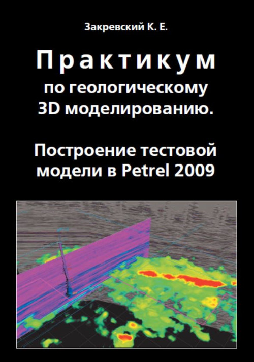
На примере тестового проекта, подготовленного на основе геолого-геофизической информации типичного российского месторождения, рассмотрены вопросы технологии построения трехмерных компьютерных геологических моделей продуктивных пластов в программном комплексе Petrel 2009 (Schlumberger).
В монографии рассматриваются вопросы построения концептуальных геологических моделей залежей углеводородов. Концептуальные геологические модели являются основой для трехмерного геологического моделирования.