Добрый день, Коллеги. Важное сообщение, просьба принять участие. Музей Ферсмана ищет помощь для реставрационных работ в помещении. Подробности по ссылке

Поиск по книгам
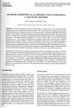
Автор(ы):John T.Paterson, Mark Cloos
Издание:PGS Publishing, Linden Park, 2005 г., 17 стр.
Язык(и)Английский
Grasberg Porphyry Cu-Au Deposit, Papua, Indonesia: Magmatic History

The Grasberg Igneous Complex, which formed at ~3 Ma, is host to one of the largest copper and gold porphyry-type ore deposits discovered on Earth. This study focuses on the magmatic characteristics of the three main phases of intrusion at the level of the open pit mine: the Dalam, subdivided into the Dalam Andesite, Dalam Volcanic and Dalam Fragmental, the Main Grasberg Intrusion (MGI), and the Kali (Early and Late). A sample suite consisting of 225 polished slabs and thin sections shows all units contain plagioclase and biotite as the dominant phenocryst phases. The Dalam Andesite, MGI and Late Kali contain(ed) hornblende as well. The Late Kali and the MGI also contained minor amounts of clinopyroxene. Apatite is ubiquitous as a trace phase. Magmatic magnetite is identifiable in the Late Kali. The magmatic groundmass in the Kali, MGI, and Dalam Andesite was potassium feldspar, albitic plagioclase, quartz and biotite. A similar groundmass assemblage probably existed in the other Dalam phase rocks, but hydrothermal alteration caused complete replacement. The phenocryst assemblages record no profound changes in magma chemistry over time, but the parent chamber was probably recharged at least twice, and possibly many times.

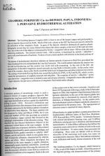
Автор(ы):John T.Paterson, Mark Cloos
Издание:PGS Publishing, Linden Park, 2005 г., 35 стр.
Язык(и)Английский
Grasberg Porphyry Cu-Au Deposit, Papua, Indonesia: Pervasive Hydrothermal Alteration

 The Grasberg Igneous Complex (GIC) is host to one of the largest copper and gold porphyry-type ore deposits discovered on Earth. Much of the rock volume in the GIC has been pervasively altered by the infiltration of hot, magmatic fluids. In parts of the deposit, alteration destroyed all igneous phases. Petrography reveals that two zones characterise almost the entire complex at the level of the open pit mine. The 1 km-wide core of the deposit is dominated by biotite + magnetite with an inner ~500 m-wide sub-zone containing andalusite. The exterior annular zone, -500 m across, is dominated by sericite + anhydrite + pyrite with small amounts of kaolinite. Pockets of rock contain epidote with chlorite in the distal portions of the GIC.

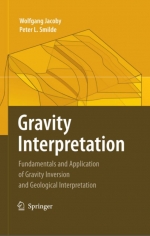
Автор(ы):Jacoby W., Smilde P.L.
Издание:Springer, 2009 г., 410 стр., ISBN: 978-3-540-85328-2
Язык(и)Английский
Gravity interpretation. Fundamentals and application of gravity inversion and geological interpretation / Интерпретация силы тяжести. Основы и применение инверсии силы тяжести и геологической интерпретации

Gravity interpretation involves inversion of data into models, but it is more. Gravity interpretation is used in a “holistic” sense going beyond “inversion”. Inversion is like optimization within certain a priori assumptions, i.e., all anticipated models lie in a limited domain of the a priori errors. No source should exist outside the anticipated model volume, but that is never literally true. Interpretation goes beyond by taking “outside” possibilities into account in the widest sense. Any neglected possibility carries the danger of seriously affecting the interpretation <...>

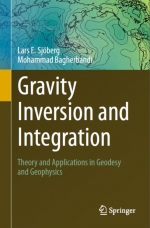
Автор(ы):Bagherbandi M., Sjoberg L.E.
Издание:Springer, 2017 г., 390 стр., ISBN: 978-3-319-50297-7
Язык(и)Английский
Gravity inversion and integration. Theory and applications in geodesy and geophysics / Инверсия гравитации и интеграция. Теория и применение в геодезии и геофизике

The task of this book is to convey some basic and in-depth knowledge on the traditional and recent theory of gravity inversion and integration for applications in geodesy and geophysics. The subject fields, physical geodesy and geophysics including geodynamics with emphasis on gravity information, are briefly introduced. Also the recent history of physical geodesy and gravimetric geophysics is reviewed. It follows that satellite techniques are indispensable for global to regional studies. The basic but important concepts of a geodetic reference system, frame and datum are also defined with examples. The Geodetic Reference System 1980, a versatile tool in most applications of gravity data, is presented in some detail. <...>

Издание 2
Автор(ы):Manahan S.E.
Издание:ChemChar Research, 2006 г., 394 стр., ISBN: 0-9749522-4-9
Язык(и)Английский
Green chemistry and the ten commandments of sustainability / Зеленая химия и десять заповедей устойчивого развития

Green Chemistry and the Ten Commandments of Sustainability, 2nd ed, was written to provide an overview of the emerging discipline of green chemistry along with the fundamental chemical principles needed to understand this science. The second edition follows the first edition published in 2004 under the title of Green Chemistry: Fundamentals of Sustainable Chemical Science and Technology, from which it differs by the inclusion of an additional chapter, Chapter 14, “The Ten Commandments of Sustainability.”

Редактор(ы):Chu J., Indraratna B., Rujikiatkamjorn C.
Издание:Elsevier, 2015 г., 810 стр., ISBN: 978-0-08-100192-9
Язык(и)Английский
Ground improvement. Case histories. Embankments with special reference to consolidation and other physical methods / Усиление грунтов. Исторические примеры. Насыпи с особым упором на укрепление и другие физические методы

There is hardly any country in the world that does not encounter problematic soil either due to natural formation or caused by manmade activities for land use and construction at a given location or at any given time. Moreover, with increasing population in many countries, it is almost inevitable that even the most marginal land and often difficult terrains are also utilised for infrastructure development.

Редактор(ы):Bristow C.S., Jol H.M.
Издание:The Geological Society of London, 2003 г., 338 стр., ISBN: 1-86239-131-9
Язык(и)Английский
Ground penetrating radar in sediments / Георадар при изучении осадочных отложений

In recent years, the use of ground penetrating radar (GPR) to investigate the shallow subsurface has transformed the study of sediments. GPR is now an accepted and widely applied tool for the earth scientist, enabling a non-destructive investigation of both modern and ancient sediments. Based on the rapid growth of this field, we organised an international research meeting entitled Ground Penetrating Radar (GPR) in Sediments: Applications and Interpretation that was held at the Geological Society of London and the University College of London in August 2001.

Издание:Sensors & Software Inc, 1999 г., 21 стр.
Язык(и)Английский
Ground Penetrating Radar. Survey design. Sensors and Software / Проникающий сквозь землю георадар. Проект обследования. Датчики и программное обеспечение

Ground penetrating radar (or GPR for short) is the general term applied to techniques which employ radio waves, typically in the 1 to 1000 MHz frequency range, to map structure and features buried in the ground (or in man-made structures). Historically, GPR was primarily focused on mapping structures in the ground; more recently GPR has been used in non-destructive testing of non-metallic structures. The applications are limited only by the imagination and availability of suitable instrumentation. <...>

Автор(ы):Hadjigeorgiou J., Potvin Y.
Издание:Australian Centre for Geomechanics, 2020 г., 270 стр., ISBN: 978-0-9876389-5-3
Язык(и)Английский
Ground support for underground mines / Крепление подземных горных выработок

Ground support has been used to stabilise underground excavations in rock since Roman times. In a review of the evolution of ground support and reinforcement, Brown (1999) refers to De Re Metallica (Agricola 1556), which describes timbering in shafts, tunnels and drifts used as a means of protection against collapse and risk of injury. Stabilisation of the immediate boundary of a rock mass surrounding an excavation is often referred to as ‘local support’. Until the 1950s, timbering remained one of the main means of local support. Since then, it has gradually been replaced by internal reinforcement techniques, such as dowels installed inside a drilled hole.

1624.03