Добрый день, Коллеги. Важное сообщение, просьба принять участие. Музей Ферсмана ищет помощь для реставрационных работ в помещении. Подробности по ссылке

Поиск по книгам
Автор(ы):Hunt R.E.
Издание:CRC Press, 2007 г., 333 стр., ISBN: 1-4200-5250-0
Язык(и)Английский
Geologic hazards. A field guide for geotechnical engineers / Геологические опасности. Полевое руководство для инженеров-геотехников

Geologic hazards represent substantial danger to humans and their works. The hazards may exist as a consequence of natural events, but often they are the result of human activities. Slope failures, such as landslides and avalanches, can occur in almost any hilly or mountainous terrain, or offshore, often with a very frequent incidence of occurrence, and can be very destructive, at times catastrophic.

Редактор(ы):Wells J.C.
Издание:Standard oil of California, San Francisco, 1967 г., 154 стр., УДК: not applicable, ISBN: not applicable
Язык(и)Английский
Geologic Interpretation of Well Logs

A manual about the principles of geophysical well log correlation, together with examples of lithologic interpretation and expressions of stratigraphic and structural features which can sometimes be recognized on well logs.

The purpose of this manual is to compile under one cover the principles of well log correlation, together with examples of lithologic interpretation and expressions of stratigraphic and structural features which can sometimes be recognized on well logs.

Издание 3
Автор(ы):Spencer E.W.
Издание:Waveland Press, 2018 г., 235 стр., ISBN: 978-1-4786-3488-1
Язык(и)Английский
Geologic maps. A practical guide to preparation and interpretation / Геологическая карта. Практическое руководство по подготовке и интерпретации

Geologic maps are among the basic tools used by anyone who wants to gain an understanding of the surface and shallow subsurface of the earth. They provide information about the types of materials that are present and the configuration of those materials in three dimensions.

Редактор(ы):Forster A., Merriam D.F.
Издание:Plenum press, New York, 1996 г., 337 стр., ISBN: 978-1-4613-4613-8017-7
Язык(и)Английский
Geologic modeling and mapping / Геологическое моделирование и картирование

Subsurface fluid flow is critically dependent on the 3D distribution of petrophysical properties in rocks. In sequences of sedimentary rocks these properties are strongly influenced by lithology and facies distribution that stem from the geologic processes that generated them.

Автор(ы):Jackson M., Lewis Teal
Издание:2002 г., 11 стр.
Язык(и)Английский
Geologic overview of the Carlin trend gold deposits / Геологический обзор золоторудных месторождений Карлин-Тренд

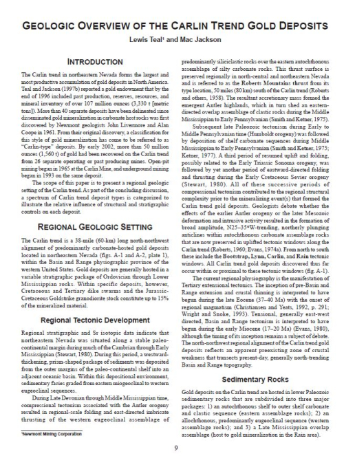
The Carlin trend in northeastern Nevada forms the largest and most productive accumulation of gold deposits in North America. Teal and Jackson (1997b) reported a gold endowment that by the end of 1996 included past production, reserves, resources, and mineral inventory of over 107 million ounces (3,330 t [metric tons]). More than 40 separate deposits have been delineated since disseminated gold mineralization in carbonate host rocks was first discovered by Newmont geologists John Livermore and Alan Coope in 1961. From their original discovery, a classification for this style of gold mineralization has come to be referred to as “Carlin-type” deposits. By early 2002, more than 50 million ounces (1,560 t) of gold had been recovered on the Carlin trend from 26 separate operating or past producing mines. Open-pit mining began in 1965 at the Carlin Mine, and underground mining began in 1993 on the same deposit.

The scope of this paper is to present a regional geologic setting of the Carlin trend. As part of the concluding discussion, a spectrum of Carlin trend deposit types is categorized to illustrate the relative influence of structural and stratigraphic controls on each deposit.

Издание 3
Автор(ы):Willis B., Willis R.
Издание:McGraw-Hill Book Company, New York - London, 1934 г., 544 стр.
Язык(и)Английский
Geologic structures

"Geologic Structures" presents the facts of the architecture of the earth and explains the action of the forces which have produced that structure. In this, the third edition, the statement of pertinent mechanical principles precedes description, and description of each type of structure, such as folds, faults, etc., precedes the analysis of the stresses and strains involved in the particular change of form.

Издание:Springer, 2021 г., 327 стр., ISBN: 978-981-16-4121-3
Язык(и)Английский
Geological and geo-environmental processes on Earth / Геологические и геоэкологические процессы на Земле

The geological (endogenic and exogenic) processes operating in interior and exterior domains of earth are bringing dynamic changes in the lithospheric and geomorphic terrains of this planet since its origin. The interplay of magmatic, tectonometamorphic and metallogenic processes is continuously evolving new continental and oceanic plates (blocks) enriched with magmatic plume and economic minerals. The diverging and converging margins of these blocks were stressed and formed orogenic mobile belts and mountains.

Автор(ы):Schluter T.
Издание:New York, 2006 г., 255 стр., ISBN: 3-540-29144-x
Язык(и)Английский
Geological Atlas of Africa (with notes on stratigraphy, tectonics, economic geology, geohazards and geosites each country) / Геологический атлас Африки (с примечаниями по стратиграфии, тектонике, экономической геологии, геологическим опасностям)

This atlas is intended primarily for anybody who is interested in basic geology of Africa. Its originality lies in the fact that the regional geology of each African nation or territory is reviewed country-wise by maps and text, a view normally not presented in textbooks of regional geology. It is my belief, that there has long been a need in universities and geological surveys, both in Africa and in the developed world, for summarizing geological maps and an accompanying basic text utilising the enormous fund of knowledge that has been accumulated since the beginning of geological research in Africa in the mid–19th century. I hope that, in part, the present atlas may satisfy this need.

Издание:1978 г., 559 стр., ISBN: 978-0707301433
Язык(и)Английский
Geological background to fossil man / Геологическая предыстория ископаемого человека

In relation to modern lines of communication it seems surprising that the Gregory Rift Valley was the last part of the system to become known. Much of the earlier exploration had however been centred on the problem of the sources of the Nile, and in consequence the Western or Albertine Rift was explored by Samuel Baker as early as 1862/63 (Baker 1866). Additionally there was a strong tendency to use the convenient base at Zanzibar Island for journeys inland by the Arab slave trading routes from Pangani and Bagamoyo; these led to the Tanganyika Rift and Nyasaland rather than to the area of modern Kenya. The first penetrations into the Gregory Rift area were in I883; Joseph Thomson made an extensive journey into Central Kenya which he described in his book of 1887, 'Through Masai Land' which had as a subtitle, 'a journey of exploration among the snowclad volcanic mountains and strange tribes of Eastern Equatorial Africa--being the narrative of the Royal Geographical Society's Expedition to Mount Kenya and Lake Victoria Nyanza i883-84'.<...>

Редактор(ы):Surdam R.C.
Издание:Springer, 2013 г., 309 стр., ISBN: 978-1-4614-5787-9
Язык(и)Английский
Geological CO2 storage characterization. The key to deploying clean fossil energy technology / Характеристика геологических запасов CO2. Ключ к внедрению экологически чистых технологий использования ископаемого топлива

The Eocene Green River Formation in Wyoming has long served as a standard for lacustrine depositional systems. This lacustrine formation, excluding the culminating phase, was deposited in a closed hydrographic basin. The position of the boundary between lake and mudflat margin was dictated by the inflow evaporation ratio (inflow greater than evaporation = transgression; inflow less than evaporation = regression).

2011.04