Добрый день, Коллеги. Важное сообщение, просьба принять участие. Музей Ферсмана ищет помощь для реставрационных работ в помещении. Подробности по ссылке

Поиск по книгам
Выпуск 256
Автор(ы):Bons P.D., Urai J.L.
Издание:Journal Tectonophysics, 1996 г., 20 стр.
Язык(и)Английский
An apparatus to experimentally model the dynamics of ductile shear zones

We present a ring-shear apparatus designed to deform soft, ductile rock analogues to arbitrarily high shear strains in simple shear, in experiments attempting to model processes that occur in natural ductile shear zones. The sintered specimen is deformed between two unsupported cylinders by two rotating grips, under a normal and shear stress up to 5 MPa and at temperatures up to 600 K. First results of experiments with octachloropropane (OCP, C3C18) and camphor (C10Hl6O) are presented.

Выпуск 97
Издание:Economic geology, 2002 г., 6 стр.
Язык(и)Английский
An evaluation of fluid inclusion microthermometric data for orpiment-realgar-calcite-barite-gold mineralization at the betze and carlin mines, Nevada

Carlin-type deposits contain gold in association with main-stage quartz-pyrite-kaolinite mineralization and late-stage orpiment-realgar-calcite-barite mineralization. Fluid characteristics for main-stage mineralization are well documented by fluid inclusion and stable isotope studies on quartz. In contrast, fluid characteristics for late-stage mineralization are not well constrained because of large ranges in fluid inclusion microthermo-metric data. These ranges could represent real variations in fluids or be a result of the reequilibration of fluid inclusions.

Microthermometric analyses were conducted on fluid inclusions in samples of barite, calcite, realgar, and or-piment from the Betze and Carlin mines, Nevada. Petrographic studies of individual crystals and cleaved sections reveal that fluid inclusions in realgar and barite have negative crystal shapes, in contrast to elongate and rounded inclusions in orpiment and calcite. Point-count data document that one-phase liquid inclusions (type 1) are the dominant type in barite and realgar, relative to two-phase, vapor-poor inclusions (type 2) in calcite and orpiment. Type 2 inclusions in realgar and barite commonly reequilibrate (e.g., stretch) during analysis and exhibit ranges in homogenization temperatures (Th) of 100º to 250ºC and 110º to 300ºC, respectively. In contrast, type 2 inclusions in orpiment and calcite have Th of 108º to 182ºC, which could be repeated to within 1ºC. Based on these results, fluid inclusions in barite and realgar are most susceptible to reequilibration, with Th of ~100º to 110ºC most representative. Fluid salinities for orpiment and calcite are 1.7 to 5.4 wt percent NaCl equiv, relative to 1.1 to 2.9 wt percent NaCl equiv for barite and realgar. The lower Th and salinity for fluid inclusions in barite and realgar suggest fluid cooling and dilution, following the deposition of paragenetically earlier orpiment and calcite.

Автор(ы):Coulson M.
Издание:Harriman House, 2008 г., 384 стр., ISBN: 9781905641550
Язык(и)Английский
An insider’s guide to the mining sector. An in-depth study of gold and mining shares / Руководство для инсайдеров по горнодобывающему сектору. Подробное исследование акций золотодобывающих компаний

It was a bright morning in early 1971. I had been seconded as part of my graduate training course at London stockbrokers James Capel to assist on the mining desk, having expressed an interest in becoming involved in international securities rather than the domestic share market. As the Jesuits say, give us the boy and we will have him for life. My lifetime addiction to mining began that spring day.

Издание 2
Автор(ы):Reynolds J.M.
Издание:Wiley Blackwell, 2011 г., 711 стр., ISBN: 978-0-471-485360
Язык(и)Английский
An introduction to applied and environmental geophysics / Введение в прикладную и экологическую геофизику

In the broadest sense, the science of geophysics is the application of physics to investigations of the Earth,Moon and planets.The subject is thus related to astronomy. Normally, however, the definition of ‘geophysics’ is used in a more restricted way, being applied solely to theEarth. Even then, the termincludes such subjects asmeteorology and ionospheric physics, and other aspects of atmospheric sciences.

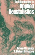
Автор(ы):Isaaks E.H., Srivastava R.M.
Издание:Oxford university press, Oxford, 1989 г., 577 стр.
Язык(и)Английский
An introduction to applied geostatistics / Введение в прикладную геостатистику

This began as an attempt to write the book that we wish we had read when we were trying to learn geostatistics, a task that turned out to be much more difficult than we originally envisaged. To the many people who provided encouragement, support, and advice throughout the writing of this book, we are very grateful.

We owe a lot to Andre Journel, without whom this book would never have been written. In addition to providing the support necessary for this project, he has been an insightful technical reviewer and an energetic cheerleader.

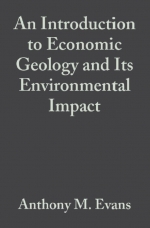
Автор(ы):Evans A.M.
Издание:Blackwell science Ltd, 1997 г., 374 стр., ISBN: 0-86542-876-X
Язык(и)Английский
An introduction to economic geology and its environmental impact / Введение в экономическую геологию и ее влияние на окружающую среду

Why is economic geology essential to our progress? It has been said that agriculture is the most basic of man's activities, but in this time of overpopulation and indeed in the preceding centuries it would have been impossible to feed the world's teeming millions without recourse to mining and the use of minerals and metals for ploughing, fertilization, harvesting, food preparation and so on. Indeed, of these two basic industries— agriculture and mining—mining is the older. It started some 500000 years ago when man commenced exploring for tool-making materials — flint, obsidian, quartzite were chipped and ground to sharp cutting edges. Early man found that some localities were richer than others and began to search for these richer deposits, to mine them, establish axe factories and to trade in the finished products. He soon developed an appreciation of their geological occurrence. For example, by 3 000 B.C. large underground flint mines were in operation at Grime's Graves in Norfolk, U.K. and it is clear that the miners had noted that particular horizons in the chalk host rock carried the best and most numerous flints.

Издание 5
Автор(ы):Benninson G.M.
Издание:Edward Arnold, 1990 г., 77 стр., ISBN: 978-1-4615-9632-5
Язык(и)Английский
An introduction to geological structures and maps / Введение в геологическое картирование и геологические структуры

This book is designed primarily for university and college students taking geology as an honours course or as a subsidiary subject. Its aim is to lead the student by easy stages from the simplest ideas on geological structures right through the first year course on geological mapping, and much that it contains should be of use to students of geology at GeE 'A' level. The approach is designed to help the student working with little or no supervision: each new topic is simply explained and illustrated by text-figures, and exercises are set on succeeding problem maps.

Издание 8
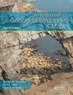
Издание:Routledge, 2011 г., 178 стр., ISBN: 978-1-032-32018-2
Язык(и)Английский
An introduction to geological structures and maps / Введение в геологическое картирование и геологические структуры

The onset and rapid spread of canals across the face of Britain in the late eighteenth century, closely followed by the building of the railway network in the early nineteenth century, were largely responsible for making the study of the strata, or stratigraphy, a subject of both practical and economic value. It is not surprising, therefore, that it was a land surveyor and canal engineer, William Smith (1769–1839), working initially in southern and eastern England, who first worked out that rock strata were not randomly disposed around the country but arranged in a definite order.

Автор(ы):Brooks M., Hill I., Kearey P.
Издание:Blackwell science Ltd, 2002 г., 280 стр., ISBN: 0-632-04929-4
Язык(и)Английский
An introduction to geophysical exploration / Введение в геофизические методы исследования

This book provides a general introduction to the most important methods of geophysical exploration. These methods represent a primary tool for investigation of the subsurface and are applicable to a very wide range of problems. Although their main application is in prospecting for natural resources, the methods are also used, for example, as an aid to geological surveying, as a means of deriving information on the Earth’s internal physical properties, and in engineering or archaeological site investigations. Consequently, geophysical exploration is of importance not only to geophysicists but also to geologists, physicists, engineers and archaeologists. The book covers the physical principles, methodology, interpretational procedures and fields of application of the various survey methods.The main emphasis has been placed on seismic methods because these represent the most extensively used techniques, being routinely and widely employed by the oil industry in prospecting for hydrocarbons. Since this is an introductory text we have not attempted to be completely comprehensive in our coverage of the subject. Readers seeking further information on any of the survey methods described should refer to the more advanced texts listed at the end of each chapter. <...>

1617.2