Добрый день, Коллеги. Важное сообщение, просьба принять участие. Музей Ферсмана ищет помощь для реставрационных работ в помещении. Подробности по ссылке

Поиск по книгам
Издание:2023 г., 20 стр.
Язык(и)Английский
A spatial data-driven approach for mineral prospectivity mapping / Основанный на пространственных данных подход к составлению карт перспективности полезных ископаемых

Mineral prospectivity mapping is a crucial technique for discovering new economic mineral deposits. However, detailed knowledge-based geological exploration and interpretations generally involve significant costs, time, and human resources. In this study, an ensemble machine learning approach was tested using geoscience datasets to map Cu-Au and Pb-Zn mineral prospectivity in the Cobar Basin, NSW, Australia.

Автор(ы):Lowrie W.
Издание:Cambridge University Press, 2011 г., 295 стр., ISBN: 978-1-107-00584-6
Язык(и)Английский
A student’s guide to geophysical equations / Руководство для студентов по геофизическим уравнениям

The advent of accessible student computing packages has meant that geophysics students can now easily manipulate datasets and gain first-hand modeling experience – essential in developing an intuitive understanding of the physics of the Earth. Yet to gain a more in-depth understanding of the physical theory, and to be able to develop new models and solutions, it is necessary to be able to derive the relevant equations from first principles. This compact, handy book fills a gap left by most modern geophysics textbooks, which generally do not have space to derive all of the important formulae, showing the intermediate steps. This guide presents full derivations for the classical equations of gravitation, gravity, tides, Earth rotation, heat, geomagnetism, and foundational seismology, illustrated with simple schematic diagrams. It supports students through the successive steps and explains the logical sequence of a derivation – facilitating self-study and helping students to tackle homework exercises and prepare for exams.

Издание:PGS Publishing, Linden Park, 2005 г., 18 стр.
Язык(и)Английский
A Tectonic Model for Porphyry Copper-Molybdenum-Gold Deposits in the Eastern Indo-Asian Collision Zone

Two Himalayan porphyry copper-molybdenum-gold belts have been developed in the eastern part of the Himalayan-Tibet orogenic zone related to the collision between the Indian and Asian Plates. Both were accompanied by the emplacement of high-level intracontinental, alkali-rich, potassic felsic magmas which produced a huge Cenozoic belt of potassic igneous rock. The emplacement of these magmas was controlled by large-scale strike-slip fault systems, orientated roughly orthogonal to the of the Indo-Asian continental convergence, which adjusted the collisional strain. The Jomda-Markam-Xiangyun copper-molybdenum belt is the western of the two, developed along a narrow zone following the Nanqian thrust, the Jinshajiang fault system, and the Red River shear zone, whereas the eastern, the Zhongdian-Yanyuan-Yao'an porphyry copper-gold-silver belt, was developed along the western margin of the Yangtze Craton. The ore-bearing porphyries have compositions which include granite, monzogranite, and monzonite, with a small amount of quartz-syenite porphyry. They are distinguished from barren porphyries by their higher Si02 (>63 wt %), lower Y (<20 ppm) and their adakitic magma affinity. All alkali-rich porphyries are relatively enriched in large-ion lithophile elements (K, Rb and Ba) and depleted in high-field strength elements (Nb, Ta, Ti and P) with a wide range of Nb/Y ratios.

Автор(ы):Carling A., Richardson K.
Издание:Geology Society of America, 2005 г., 110 стр., ISBN: 0-8137-2392-2
Язык(и)Английский
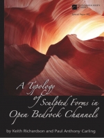
A typology of sculpted forms in open bedrock channels / Типология скульптурных форм коренных пород в открытых руслах

Erosional sculpted forms from open bedrock channels in a variety of lithologies are described, classified, and illustrated. The resulting typology demonstrates both the diversity of bedforms in bedrock channels and the existence of features common to many channels and lithologies. This investigation develops a consistent nomenclature and places the study of bedforms in bedrock channels on a rational foundation along with that of their sedimentary counterparts.

Выпуск 20
Редактор(ы):Osmolska H.
Издание:Panstwowe Wydawnictwo Naukowe, Warszawa, 1975 г., 139 стр.
Язык(и)Английский
Acta paleontologica Polonica. Vol XX

Relatively frequently found, the specimens of Homalonotinae are, in general, poorly preserved and, therefore, they are among the groups of trilobites that have so far been rather insufficiently studied. Since their occurrence is limited to the Llandovery through Middle Devonian, they may serve as a good index fossil. Their paleogeographical and correlative importance in the Upper Silurian and Lower Devonian was discussed separately (Tomczykowa, 1974).

The materials, on which the present paper is based, were collected by the writer in 1956—1958 in the Holy Cross Mts. Most of them, however, come from the boreholes managed by the Geological Institute, that is, from Goldap, Bostow, Ciepielow, Bialopole, Krowie Bagno, Lopiennik, Strzelce IG-2 and Zakrzew IG-3, as well as from the drillings of the Oil Research Survey (Malochwiej and Rozkopaczew boreholes) (Text-fig.  1). <...>

Автор(ы):Nara D., Sain K.
Издание:John Wiley & Sons INC, 2023 г., 145 стр., ISBN: 978-1119594864
Язык(и)Английский
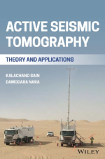
Active seismic tomography. Theory and applications / Активная сейсмотомография. Теория и применение

The seismic method is one of the most promising geophysical methods that can help to explore the Earth’s interior. Numerous technology developments have been introduced in seismic methods over the decades to either understand or to use the full recorded seismic data from the field. Seismic tomography is a seismic imaging technique used to delineate the subsurface linked with structures and numerical values of different physical parameters such as the seismic velocity, density, etc.

Издание 2
Автор(ы):Keller E.A., Pinter N.
Издание:Pearson Prentice Hall, 2002 г., 362 стр., ISBN: 0-13-088230-5
Язык(и)Английский
Active tectonics. Earthquakes, uplift and landscape / Активная тектоника. Землетрясения, поднятия и ландшафты

Active tectonics is the study of dynamic tectonic processes that shape the landscape and have an impact on human society. Tectonic geomorphology is the part of active tectonics that is concerned with landforms produced by tectonic processes and the application of geomorphic principles to tectonic problems. Tectonic geomorphology increasingly has become one of the principal tools in a variety of applications, including identification of active faults, formation of geologic structures, seismic-hazard assessment, and the study of landscape evolution. Tectonic geomorphology has proven to be useful in these applications because tectonically produced landforms are created and preserved over time intervals ideal for recording landscape change. <...>

Автор(ы):Keller E.A., Pinter N.
Издание:Prentice-Hall Inc, 1996 г., 338 стр., ISBN: 0-02-304604-5
Язык(и)Английский
Active tectonics. Earthquakes, uplift and landscape / Активная тектоника. Землетрясения, поднятия и ландшафты

In the geological sciences, the term "tectonics" refers to the processes, structures and landforms associated with deformation of the Earth's crust. In a broader sense, it refers to the evolution of these structures and landforms over time. On a global scale, we are concerned with the origin of continents and ocean basins, he which are the largest landforms produced by tectonics on Earth At the regional scale, we are-interested in structures that produce mountain chains. <...>

2019.22