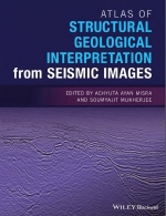
Remote sensing has been immensely useful in tectonics, structural geology, and geomorphic studies (e.g. Misra et al. 2014; Dasgupta and Mukherjee 2017, 2019; Shaikh et al. 2020; Dasgupta et al. 2022). This edited book consists of 24 chapters authored and co-authored by 53 persons from 21 academic organizations and industries from 7 countries.
Misra (2022a; Chapter 1) presents the definition, fundamental processes, and scopes of remote sensing in structural geologic and geomorphologic studies. Misra (2022b; Chapter 2) pens the next introductory chapter, which classifies remote sensing based on data type, source, platform, and imaging media. Gupta and Biswas (2022, Chapter 3) present a morpho-tectonic analysis of a mid-channel bar using remote sensing images from the Jaldhaka river (India). Deota et al. (2022, Chapter 4) present geomorphic indicators of glacier retreat from Jorya-Garang glacier, Baspa Valley (India). They identify different stages of moraines. Jordan (2022, Chapter 5) presents several interesting aerial views of the 2018 Kilauea eruption (U.S.A). Geomorphic features such as lava fissures are documented from images. Awais (2022, Chapter 6) documents different kinds of depositional systems observable in images in Google Earth, viz. different rivers, deltas, lakes, alluvial fans, dunes, and estuaries. Patel et al. (2022, Chapter 7) discuss in detail badland geomorphology from images and several field photos. Their study area was Garbeta (India). Dongare et al. (2022, Chapter 8) discuss the geomorphology of the Indian west coast.


