Добрый день, Коллеги. Важное сообщение, просьба принять участие. Музей Ферсмана ищет помощь для реставрационных работ в помещении. Подробности по ссылке

Поиск по книгам
Автор(ы):Galloway W.E., Hobday D.K.
Издание:Springer-Verlag, 1983 г., 305 стр., ISBN: 0-387-90827-7
Язык(и)Английский
Terrigenous clastic depositional systems. Applications to petroleum, coal, and uranium exploration / Системы терригенно-обломочных отложений. Применение в разведке нефти, угля и урана

Nonrenewable energy resources available in very large quantities are limited to heavy hydrogen and dry geothermal energy. Large-scale renewable resources are solar and atmospheric electricity (Moody, 1978). These four may be regarded as the ultimate energy sources, but they are unlikely to contribute significantly to the total energy budget for at least the next few decades. Synthetic fuels are already in production, but widespread conversion is being held back by economic and environmental considerations. Wind, water, and biomass conversion will play an enlarged, but still relatively minor, role. This leaves coal, uranium, and petroleum to provide the bulk of the immediately foreseeable energy requirements.

Автор(ы):Asch K.
Издание:Hannover, 2003 г., 187 стр., ISBN: 3-510-95903-5
Язык(и)Английский
The 1:5 million international geological map of europe and adjacent areas: Development and implementation of a GIS-enabled concept / Международная геологическая карта Европы и прилегающих территорий масштаба 1:5 миллионов: разработка и внедрение концепции

The 1 : 5 000 000 International Geological Map of Europe and Adjacent Areas (IGME 5000) is a truly multidisciplinary project. It crosses three domains: geology, Information Technology and cartography. Within geology it embraces many sub-disciplines: stratigraphy, petrography, European regional and historical geology and marine geology.

Автор(ы):Lin A.
Издание:Springer, 2017 г., 194 стр., ISBN: 978-981-10-5854-7
Язык(и)Английский
The 2016 Mw 7.1 Kumamoto Earthquake. A photographic atlas of coseismic surface ruptures related to the Aso Volcano, Japan / Землетрясение Кумамото 2016-го года интенсивностью 7.1 балла. Фотографический атлас сейсмических разломов поверхности, связанных с

The Mw 7.1 (Mj 7.3) Kumamoto earthquake occurred on April 16, 2016, resulting in more than 100 deaths and extensive damage on Kyushu Island in southwestern Japan. In order to determine the motion of the seismogenic fault, ground deformation, and relationships between coseismic surface ruptures and pre-existing faults, our survey group conducted fieldworks immediately, beginning one day after the main shock.

Редактор(ы):Gyula G., Medak D., Pinter N., Stein S., Weber J.
Издание:Springer, 2006 г., 412 стр., ISBN: 978-1-4020-4234-8
Язык(и)Английский
The Adria microplate: GPS geodesy, tectonics and hazards / Микроплита Адриа: GPS-геодезия, тектоника и опасности

Since its first application to geodynamical problems, GPS geodesy has gradually revealed the nature of motion and deformation for most active areas of deformation across the Earth. One of the last remaining regionalscale problems is the motion and associated deformation in the peri-Adriatic region. Selected local-scale studies have examined aspects of this motion, but to date no regional team has systematically attacked the full regional scope of designed to bring together an international group of scientists working in the peri-Adriatic region to: (1) review research activities and results completed to date, (2) share technical expertise, and (3) provide a springboard for future collaborative research on Adria geodynamics <...>

Редактор(ы):Eisenberg J., Runge J.
Издание:CRC Press, 2018 г., 236 стр., ISBN: 978-1-138-06212-2
Язык(и)Английский
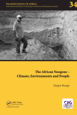
The African neogene –  climate, environments and people / Неоген Африки - климат, окружающая среда и люди

It is with deep regret to report that ‘Palaeoecology of Africa (PoA)’ lost two of its long-time editorial board members: the German-born, US-American geographer, palaeoecologist and archaeologist, Karl W. Butzer in 2016; and the French palaeobiologist (diatom specialist), palaeoclimatologist and palaeohydrologist, Françoise Gasse in 2014. Both supported and accompanied over many years the long-term success story of PoA.

Издание:Doklady Earth Science, 2007 г., 4 стр.
Язык(и)Английский
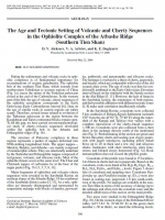
The Age and Tectonic Setting of Volcanic and Cherty Sequences in the Ophiolite Complex of the Atbashe Ridge (Southern Tien Shan)

Dating the sedimentary and volcanic rocks in ophiolite complexes is of fundamental importance for reconstructions of oceanic paleobasins. The ophiolite belt of the southern Tien Shan, which extends from northwestern Uzbekistan to western regions of China (Fig. 1a), traces the suture of the Turkestan paleocean closed at the end of the Carboniferous. In the western part of the belt, the age of volcanic–cherty sequences of the ophiolite association corresponds to the Early Ordovician–Early Carboniferous interval [6]. Data on the age of similar rocks in eastern regions are rather scanty. Therefore, several issues related to evolution of the Turkestan paleocean in the region between the Kazakhstan and Tarim continental blocks remain open. To fill this gap, we have carried out micropaleontological study of cherty–volcanic sequences developed within the ophiolite belt in the Atbashe and Dzhangdzhir ridges (Fig. 1b).

The structure of Paleozoic complexes in these regions represents a packet of nappes deformed into NNE-striking longitudinal folds. The upper nappes—Shirekty, Balykty, and Atbashe—are mainly composed of metamorphic schists. They are structurally underlain by the Tashrabat and Dzhangdzhir nappes composed of terrigenous, volcanic, and siliceous rocks. Most of the ophiolite thrusts occur at the same level. The Ulan and Chirmash nappes of carbonates lie at the base of the nappe packet (Fig. 1b) [1, 3, 5, 8, 11]. Major fragments of ophiolites and volcanic–cherty sequences were revealed in the Sarybulak Ravine on northern slopes of the Atbashe Ridge, 18 km southwest of the Sarybulak district center [5, 11]. As a rule, ophiolites are intensely disintegrated and represented by serpentinite melange with blocks of dunites, pyroxenites, gabbroids, and metamorphic and siliceous rocks. The melange is overlain by a sheet of cherts, jasperoids, and basalts, which are comparable with rocks of the old oceanic plate cover. The age of rocks was thus far conditionally attributed to the Early Ordovician–Devonian interval based on the similarity with the Sartale section in the Alai Ridge [5, 11]. However, the lack of fauna in

the Sarybulak section, the remoteness of both regions, and their possible affiliation with different tectonic zones [1, 8] make such correlation insufficiently reliable. <...>

Автор(ы):Kresten P., Troll V.R.
Издание:Springer, 2018 г., 221 стр., ISBN: 978-3-319-90223-4
Язык(и)Английский
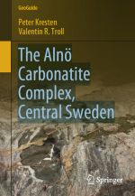
The Alnö Carbonatite Complex, Central Sweden / Карбонатитовый комплекс Ално, Центральная Швеция

Carbonatites are by the International Union of Geological Sciences classified as igneous rocks containing more than 50% (modal) of primary (i.e. magmatic) carbonate minerals and less than 20 wt.% SiO2. Depending on the dominating carbonate mineral(s), the carbonatites can be further subdivided into Ca-rich (calciocarbonatites), Mg-rich (dolomite carbonatites), Fe-rich (ankerite carbonatites) and Na-rich (natrocarbonatites). They occur on all continents on Earth, including Antartica, and range in age from approximately 3 billion years old until the present day (Woolley and Kjarsgard 2008). <...>

Автор(ы):Francisco Camus
Издание:PGS Publishing, Linden Park, 2005 г., 19 стр.
Язык(и)Английский
The Andean Porphyry Systems

The Chilean Andes comprise the most richly endowed copper province on Earth. A total resource (including production) of about 490 million tonnes of fine copper has been identified in more than 63 porphyry copper deposits and numerous prospects.

Andean porphyry deposits occur along five metallogenic belts that extend from central Chile to southern Peru and northwest Argentina. They formed between the Early-Late Cretaceous and Pliocene. Within these belts the deposits occur in clusters associated with multiphase plutonic complexes. This relationship is particularly prevalent in the Late Eocene-Oligocene belt, the most prolific of all. The time span between the oldest and youngest belt corresponds to the period in which contractional tectonism of the Andean cycle was established and developed from Late Cretaceous to Recent.

Выпуск 19
Издание:Journal Ore geology reviews, 2002 г., 45 стр.
Язык(и)Английский
The Archean Chalice gold deposit: a record of complex, multistage, high-temperature hydrothermal activity and gold mineralisation associated with granitic rocks in the Yilgarn Craton, Western Australia

The Chalice gold deposit (~ 20 t Au produced), in the southwestern portion of the Late-Archean Norseman-Wiluna greenstone belt of the Yilgarn Craton, Western Australia, is hosted both in a sequence of intercalated mafic and ultramafic amphibolites and a post-peak metamorphism monzogranite dike. The deposit is flanked on the western side by calc-alkaline plutonic rocks, and to the east by a predominantly monzogranitic pluton, with at least four generations of monzogranitic dikes that intrude the local mine stratigraphy. Locally, four deformation events (D1–D4) have affected this sequence of amphibolites, and two stages of gold mineralisation are recognised, controlled by the progressive D2 event.

1932.83