Добрый день, Коллеги. Важное сообщение, просьба принять участие. Музей Ферсмана ищет помощь для реставрационных работ в помещении. Подробности по ссылке

Поиск по книгам
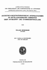
Автор(ы):Brinkmann R.
Издание:Weidmannsche Buchhandlung, Berlin, 1929 г., 266 стр.
Язык(и)Немецкий
Statistisch-biostratigraphische untersuchungen an mitteljurassischen ammoniten uber artbegriff und stammesentwicklung / Статистико-биостратиграфические исследования среднеюрских аммонитов о видовом понятии и эволюции племен

Die Anregung zu den vorliegenden Untersuchungen erhielt ich im Jahre 1925, als ich auf einer Exkursion zum Studium des englischen Jura die Aufschlüsse bei Peterborough kennen lernte, die mir die Möglichkeit zu bieten schienen, die phylogenetische Entwicklung der Ammoniten auf Grund eines sehr reichen, selbstgesammelten Materiales genauer als bislang zu studieren.

Издание:International atomic energy agency, Vienna, 1996 г., 129 стр.
Язык(и)Английский
Steps for preparing uranium production feasibility studies: A guidebook / Этапы подготовки технико-экономического обоснования добычи урана: руководство

The search for a mineral commodity, uranium included, and its eventual production is basically an economic activity. A realistic assessment of the economic viability of a project, whether to fulfill domestic needs or to meet world demand, should therefore be carried out as early and as frequently as possible.

Издание 2
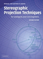
Автор(ы):Leyshon P.R., Lisle R.J.
Издание:Cambridge University Press, 2004 г., 120 стр., ISBN: 978-0-521-82890-1
Язык(и)Английский
Stereographic projection techniques for geologists and civil engineers / Методы стереографической проекции для геологов и инженеров-строителей

The stereographic projection is an essential tool of geologists and civil engineers which allows threedimensional orientation data to be both represented and manipulated. It provides a way of graphically displaying the data collected which is essential for the recognition and interpretation of patterns of preferred orientation. It allows also the data to be processed, rotated and analysed by means of a number of standard geometrical constructions. The latter can be rapidly carried out using computer software but the stereographic method has the advantage that the constructions can be visually appreciated and shown graphically.

Автор(ы):Dimitrakopoulos R.
Издание:7 стр.
Язык(и)Английский
Stochastic mine planning – methods, examples and value in an uncertain world / Стохастическое планирование горных работ – методы, примеры и ценность в условиях неопределенности

Conventional approaches to estimating reserves, optimising mine planning and production forecasting result in single, often biased,
forecasts. This is largely due to the non-linear propagation of errors in understanding orebodies throughout the chain of mining.

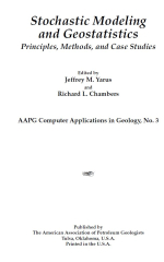
Редактор(ы):Chambers R.L., Yarus J.M.
Издание:American Association of Petroleum Geologists, 1994 г., 341 стр., ISBN: 0-89181-702-6
Язык(и)Английский
Stochastic modeling and geostatistics. Principles, methods and case studies / Стохастическое моделирование и геостатистика. Принципы, методы и тематические исследования

In the fall of 1988 the Society of Petroleum Engineers (SPE) held a forum on reservoir characterization in Grindenwald, Switzerland. Many of the authors who have contributed to this volume were at that forum discussing their ideas on stochastic methods for reservoir characterization. All of these ideas were then still quite new and largely untested; indeed, some of them had not been reduced to practice, but were merely the wild imaginings of creative and curious minds. At that time, there was still a fair bit of controversy over whether stochastic methods had any relevance to the practice of modeling petroleum reservoirs.*

Том 2
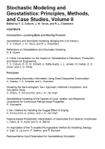
Редактор(ы):Chambers R.L., Coburn T.C., Yarus J.M.
Издание:American Association of Petroleum Geologists, 2006 г., 312 стр., ISBN: 0891817042
Язык(и)Английский
Stochastic modeling and geostatistics. Principles, methods and case studies. Volume 2 / Стохастическое моделирование и геостатистика. Принципы, методы и тематические исследования. Часть 2

Since publication of the first volume of Stochastic Modeling and Geostatistics in 1994, there has been an explosion of interest and activity in geostatistical methods and spatial stochastic modeling techniques. Many of the computational algorithms and methodological approaches that were available then have greatly matured, and new, even better ones have come to the forefront. Advances in computing and increased focus on software commercialization have resulted in improved access to, and usability of, the available tools and techniques. Against this backdrop, Stochastic Modeling and Geostatistics Volume II provides a much-needed update on this important technology. As in the case of the first volume, it largely focuses on applications and case studies from the petroleum and related fields, but it also contains an appropriate mix of the theory and methods developed throughout the past decade. Geologists, petroleum engineers, and other individuals working in the earth and environmental sciences will find Stochastic Modeling and Geostatistics Volume II to be an important addition to their technical information resources.

Автор(ы):Aoki K.
Издание:CRC Press, 2023 г., 300 стр., ISBN: 978-0367420772
Язык(и)Английский
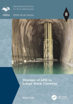
Storage of LPG in large rock caverns. ISRM Book series / Хранение сжиженного газа в больших скальных пещерах. Серия книг ISRM

Under Japan’s energy policy, the Japan Organization for Metals and Energy Security (JOGMEC) operates the national stockpiling project of crude oil and liquefied petroleum gas (LPG). In addition to three existing above-ground LPG tank facilities, in 2002, construction began on two of the world’s largest facilities, Kurashiki (capacity 400,000 t) and Namikata (450,000 t). These rock cavern storage systems were completed in 2012 allowing the longterm stockpiling operation to continue.

For the first time in Japan, these two high pressure gas storages adopted the hydrodynamic containment system, in which the groundwater pressure holds the gas in unsealed rock tunnels. They are of the world’s largest class.<...>

Автор(ы):Mazzoli S.
Издание:Springer-Verlag, 1995 г., 13 стр.
Язык(и)Английский
Strain analysis in Jurassic argillites of the Monte Sirino area (Lagonegro Zone, southern Apennines, Italy) and implications for deformation paths in pelitic rocks / Анализ деформаций в юрских аргиллитах района Монте-Сирино (зона Лагонегро, южные Апеннины

Analysis of strain in Jurassic argillites forming part of the folded and thrusted sedimentary succession of the Lagonegro basin (southern Italian Apennines) has been carried out using ellipsoid-shaped 'reduction' spots as strain markers. Most of the determined finite strain ellipsoids are of oblate type and show a peculiar distribution of the maximum extension direction (X), with maxima either subparallel or subperpendicular to the local fold axes.

Автор(ы):Ionesi B.
Издание:Editura Academiei Republicii Populare Romine, Bucuresti, 1968 г., 382 стр.
Язык(и)Румынский
Stratigrafia depozitelor miocene de platforma dintre valea siretului si valea moldovei  / Стратиграфия миоценовых отложений на платформе между долиной Сирет и долиной Молдовы

Studiul geologici Platformei Moldovene§ti §i in special a depozitelor neogene a constituit o preocupare permanentà a cercetàtorilor ie§eni, aceasta marcìnd o veche tradire. Incepìnd cu anul 1862, cìnd a apàrut lucrarca lui G r. Cobàlcescu Calcami de la Bàpidea, §i pina in pre-zcnt s-au adus contribuii importante asupra orizontàrii, delimitàrii §i ràspìndirii sedimcntelor neogene, asupra tectonicii §i con^inutului fau-nistic. In ce prive§te fauna acestor sedimente, s-au efectuat studii amànun-ite in special asupra molu§telor §i foraminiferelor, pe baza càrora s-au sta-bilit, de altfel, delimitàrile stratigrafice dintre subdiviziunile neogenului. <...>


Выпуск 136
Издание:Journal Marine Geology, 1997 г., 13 стр.
Язык(и)Английский
Stratigraphic numerical modelling of a carbonate platform on the Romanche transverse ridge, equatorial Atlantic

The Romanche transverse ridge (equatorial Atlantic) is located in the northern flank of the fracture zone, opposite the eastern ridge-transform intersection (RTI). It constitutes a major positive topographic anomaly that reaches a height of over 4 km above the level predicted by the thermal subsidence curve. A series of E-W aligned peaks, located on the crest of the transverse ridge, were at sea level during early and middle Miocene times; they are presently capped by a ~300 m thick, shallow-water carbonate platform that grew on a subsiding oceanic crust basement surface flattened by erosion at sea level. These structures are now about 1 km below sea level. High resolution seismic reflection surveys and multibeam morphobathymetry as well as study of samples recovered from the carbonate platform allowed a reconstruction of the paleoenvironment and of the vertical movements of the peaks starting from the lower Miocene. Ages derived from microfossils suggest that the base of the carbonate platform dates from 17-25 m.y. ago and the sinking of the platform started between 18 and 13 m.y. ago. These data were included in a numerical simulation model that takes into account thermal and tectonic subsidence, growth potential of the carbonates, subaerial and submarine erosion rates and Mio-Pliocene absolute sea level fluctuations. The results outline the subsidence history of the Romanche transverse ridge and suggest post-Miocene subsidence faster than that predicted by the thermal cooling model.


1438.66