Добрый день, Коллеги. Важное сообщение, просьба принять участие. Музей Ферсмана ищет помощь для реставрационных работ в помещении. Подробности по ссылке

Поиск по книгам
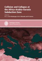
Издание:The Geological Society, London, 2009 г., 373 стр.
Язык(и)Английский
Collision and collapse at the Africa–Arabia–Eurasia subduction zone (Коллизия и коллапс в Африкано-Аравийско-Евразийской зоне субдукции)

Настоящий сборник включает в себя 13 работ, в которых рассматриваются различные вопросы геодинамики, стратиграфии, истории геологического развития, магматизма, метаморфизма, кинематики региона, находящегося на стыке Африки, Саудовской Аравии и восточной Европы с позиций тектоники плит, т.е. как зоны субдукции и связанной с ней орогении.

The Society makes every effort to ensure that the scientific and production quality of its books matches that of its journals. Since 1997, all book proposals have been refereed by specialist reviewers as well as by the Society’s Books Editorial Committee. If the referees identify weaknesses in the proposal, these must be addressed before the proposal is accepted.

Once the book is accepted, the Society Book Editors ensure that the volume editors follow strict guidelines on refereeing and quality control. We insist that individual papers can only be accepted after satisfactory review by two independent referees. The questions on the review forms are similar to those for Journal of the Geological Society. The referees’ forms and comments must be available to the Society’s Book Editors on request.

Although many of the books result from meetings, the editors are expected to commission papers that were not presented at the meeting to ensure that the book provides a balanced coverage of the subject. Being accepted for presentation at the meeting does not guarantee inclusion in the book.

More information about submitting a proposal and producing a book for the Society can be found on its web site: www.geolsoc.org.uk.

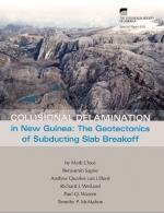
Издание:Geology Society of America, 2005 г., 54 стр., ISBN: 0-8137-2400-7
Язык(и)Английский
Collisional delamination in New Guinea: The geotectonics of subducting slab breakoff / Коллизионное расслоение в Новой Гвинее: Геотектоника субдуцирующего слэба

The spine of the island of New Guinea, the Central Range, is a 1300 km long by 100 to 150 km wide mountain belt with numerous peaks over 3 km elevation. This mountain belt began to form when the Australian passive margin entered a northdipping subduction zone in the Middle Miocene. Regional relationships and fi eldwork near the Ertsberg (Gunung Bijih) mining district in the western Central Range are the basis for making a detailed reconstruction of the events leading up to, and during, collisional orogenesis.<...>

Редактор(ы):Nguyen A.V., Schulze H.J.
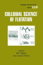
Издание:CRC Press, 2004 г., 878 стр., ISBN: 978-750-8400
Язык(и)Английский
Colloidal science of flotation / Коллоидная наука о флотации

Froth flotation is an outstanding example of applied interfacial and colloidal science. It has roots in the nineteenth century discoveries concerning the separation and concentration of valuable minerals from ores, and is considered as one of the most important achievements of the twentieth century, which has significantly contributed to the vast expansion of the raw material industry. Efforts to understand the mechanisms governing flotation led to the research into the wetting and dewetting statics and dynamics, and the intervening free and wetting liquid films as early as the 1930s. Surface forces operating across the films were also appreciated at that time. These efforts have provided stimuli for advances in the theory of interparticle forces with the development of several sophisticated experimental techniques <...>

Издание:CCRR, 2018 г., 65 стр.
Язык(и)Английский
Colombian Standard for the Public Reporting of Exploration Results, Mineral Resources and Reserves (ECRR) / Колумбийский стандарт публичной отчетности о результатах разведки, минеральных ресурсах и запасах (ECRR)

Throughout the Standard, certain words are used in a general sense when a more specific meaning might be attached to them by particular commodity groups within the industry. In order to avoid unnecessary duplication, a non-exclusive list of generic terms is tabulated below together with other terms that may be regarded as synonymous for the purposes of this document. <...>

Автор(ы):Alean J.C., Hambrey M.J.
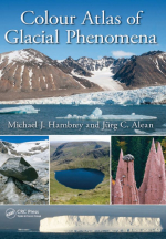
Издание:CRC Press, 2017 г., 426 стр., ISBN: 978-1-4822-3440-4
Язык(и)Русский
Colour atlas of glacial phenomena / Цветной атлас ледниковых явлений

Glaciers and ice sheets are among the world’s most beautiful and fascinating natural wonders. Whereas today glacier ice covers approximately a tenth of Earth’s land surface, during the ice ages of the last few million years, as much as a third of the land surface was covered by glacier ice. Modern glaciers and ice sheets possess many interesting features that reflect their dynamics, their interaction with landscape, rock, sediment and water, and they also inform us about climate change. The legacy of ice masses is reflected in the presence of a variety of landforms and sediments, many of which are also recorded in the rock record. The value of glaciers to society is immense.

Издание:2007 г., 16 стр.
Язык(и)Английский
Combining data from multiple years or areas to improve variogram estimation / Объединение данных за несколько лет или областей для улучшения оценки вариограммы

A requirement for geostatistical prediction is estimation of the variogram from the data. Often low sample size is a major impediment to elucidating a variogram even for a highly autocorrelated spatial process. This paper presents a methodology for improving variogram estimation when samples exist from multiple years or regions sharing a similar process for generating spatial autocorrelation.

Редактор(ы):Liverman D.G.E., Marker B., Pereira C.P.G.
Издание:The Geological Society of London, 2008 г., 211 стр., ISBN: 978-1-86239-260-1
Язык(и)Английский
Communicating environmental geoscience / Обмен информацией в экологических науках о Земле

This collection of papers is aimed primarily at the environmental geoscientist faced with the challenges of communicating important scientific results to those who might benefit from them, whether they are politicians, policy-makers, potential victims of geological disasters, fellow scientists or other members of the public. Environmental geoscience has grown to become one of the most important disciplines of geoscience as a whole, and scientific methods of investigation have become sophisticated and effective at addressing numerous problems that directly affect health and safety. The audience for such research thus is wide, and for such research to be used in the most effective manner requires well-developed communication skills to reach an audience that varies greatly in education and ability to comprehend scientific concepts. The implications of failing to communicate effectively may be severe: geological disasters have had a massive economic and social impact, with major loss of life.

Автор(ы):Magara K.
Издание:Elsevier, 1978 г., 342 стр., ISBN: 0-444-41654-4
Язык(и)Английский
Compaction and fluid migration. Practical petroleum geology / Уплотнение и миграция жидкости. Практическая нефтяная геология

Conventional oil and gas are usually found in pore spaces and fracture openings of sandstones, limestones, and dolomite. Shales, although considered to be important in many cases as source rocks and cap rocks for hydrocarbons, usually do not contain commercial oil and gas. In other words, from the standpoint of production, shales are relatively useless rocks.

If, for example, an exploratory well were drilled and a geologist tried to evaluate whether it had penetrated oil and/or gas accumulations, he would first separate the shaly sections as being of no interest, and then try to find out whether the other sections were oil-(and/or gas-) saturated or watersaturated. <...>

Выпуск 83
Автор(ы):Beaty D.W., Holland P.T., Snow G.G.
Издание:Economic geology, 1988 г., 23 стр.
Язык(и)Английский
Comparative elemental and oxygen isotope geochemistry of jasperoid in the Northern Great Basin: evidence for distinctive fluid evolution in gold-producing hydrothermal systems / Сравнительная элементная и кислородно-изотопная геохимия яшмы в северной част

This comparative geochemical study of jasperoid in the northern Great Basin is based on 65 samples from 10 Carlin-type gold deposits and 22 similar but apparently barren hydro-thermal systems. Multielement geochemistry coupled with oxygen isotope data indicate that hydrothermal fluids in barren and mineralized systems evolved in different ways, and that there are fundamental geochemical differences among the various gold-producing deposits of the area.

Much of the variation in the jasperoid geochemical data can be explained in terms of seven abstract end-member components obtained through factor analysis. Three of these components (factors) dominate the results and are related to common products of alteration and mineralization in epithermal systems of the northern Great Basin. Element associations for these factors are: factor 1: Ti02, Al203, La, K20, Sr, Fe203, Th; factor 2: Au, Ag, Sb, Si02> As, Pb; and factor 3: W, B, V, Zn, Co, Au, CaO, Ni, Mn, Cu.

1959.58