Добрый день, Коллеги. Важное сообщение, просьба принять участие. Музей Ферсмана ищет помощь для реставрационных работ в помещении. Подробности по ссылке
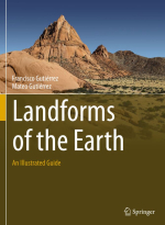
Landforms of the Earth. An illustrated guide / Формы рельефа Земли. Иллюстрированный путеводитель
Geomorphology literally means the study of the Earth’s landforms. It is defi ned by the International Association of Geomorphologists (IAG; www.geomorph.org) as the interdisciplinary and systematic study of landforms and their landscapes, as well as the Earth surface processes that create them. Geomorphologists investigate landforms and landscapes addressing multiple aspects, such as their genesis, morphometry , chronology and past and future evolution. They also investigate Earth surface processes not only to understand their morphogenetic role, but also to gain a scientifi c basis for assessing and managing a great deal of environmental problems associated with them, notably geohazards (e.g. landslides, fl oods, subsidence, earthquakes).
The concept of geomorphology has rapidly evolved over its short history. During its initial stages, the pioneers of the discipline were mainly interested on the reconstruction of the long-term evolution of present-day landscapes ( historical geomorphology ). That was a period during which geoscientists were largely focused on obtaining information about the past. This retrospective approach was commonly based on the application of the uniformitarianism principle: “the present is the key to the past”. In a subsequent phase, qualitative descriptions were replaced by quantitative studies on both processes and landforms, largely thanks to the development of new technologies. Measuring the dimensions of landforms (morphometry), analysing their spatial distribution and frequency and quantifying rates of processes and the associated morphological changes are some of the main targets of quantitative geomorphology . Both historical and quantitative investigations have benefi ted by the advent of new dating techniques that allow determining the age of landforms and deposits and calculating temporal frequencies and rates; no dates no rates. Recently, there has been a signifi cant trend to applying geomorphology as a tool for assessing and mitigating environmental problems like hazards and impacts ( applied or environmental geomorphology ). Nowadays, a major challenge is the development of reliable predictions on the future behaviour of Earth surface processes and landforms. This prospective approach is usually developed by using the present and the past as the key to the future, through a reverse uniformitarianism concept.
Modern geomorphologists are more worried about the surface processes that operate today and those that will have consequences tomorrow, because they affect our society. This concern is largely motivated by three factors: (1) Damage related to various hazardous geomorphological processes (e.g. fl oods, landslides) is increasing exponentially. (2) Humans are currently one of the main geomorphic agents by causing direct changes on the land surface or by producing disturbances that signifi cantly change the dynamics of geomorphic systems. From 1900 AD to 2000 AD, the world population increased fourfold to almost six billion people, and economic activity increased 40-fold. In fact, a new geological epoch called the Anthropocene has been proposed, covering the period during which human activities have had a profound imprint on the Earth’s landscapes and ecosystems. (3) There is a need to forecast the numerous impacts of the anthropogenic global warming on geomorphic systems, some of which will have signifi cant detrimental effects for our society (e.g. sea-level rise). The current boom of geomorphology is most probably due to its social relevance. <...>


