Добрый день, Коллеги. Важное сообщение, просьба принять участие. Музей Ферсмана ищет помощь для реставрационных работ в помещении. Подробности по ссылке
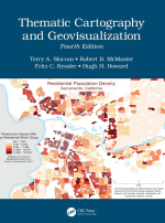
Thematic cartography and geovisualization / Тематическая картография и геовизуализация
We are pleased to offer this fourth edition of Thematic Cartography and Geovisualization published by CRC Press. We deem a fourth edition particularly appropriate given the extensive developments that have taken place in cartography and GIScience since the third edition was first published in 2009. One development is the continued evolution of the Internet and the associated World Wide Web, which is commonly referred to as Web 2.0. One characteristic of Web 2.0 is the ability to harness the collective intelligence of Web users. In the case of geography, we often refer to this collective intelligence as “volunteered geographic information” or VGI; an example of VGI is OpenStreetMap (openstreetmap.org/). The second characteristic of Web 2.0 is lightweight programming models that enable the creation of “map mashups” by combining geographic data from one source with a map from another source. For example, HealthMap uses data feeds from sources such as the World Health Organization and others to plot disease outbreaks on an interactive world map (healthmap.org/en/). The third characteristic of Web 2.0 is the ability to work with social media such as Facebook and Twitter. Although social media sites may not seem relevant to cartography, geographers and other social scientists often analyze and map the character of social media content. For instance, Mapbox allows users to map geotagged tweets from Twitter accounts using code listed at mapbox.com/blog/twitter-map-every-tweet/. The fourth edition considers these and other developments in Web 2.0.1 <...>


