Добрый день, Коллеги. Важное сообщение, просьба принять участие. Музей Ферсмана ищет помощь для реставрационных работ в помещении. Подробности по ссылке
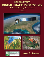
Introductory digital image processing. A remote sensing perspective / Вводная информация о цифровой обработке изображений. Перспективы дистанционного зондирования
T he 4th edition of Introductory Digital Image Processing: A Remote Sensing Perspective provides up-to-date information on analytical methods used to analyze digital remote sensing data. T he book is ideal for introductory through graduate level university instruction in departments that routinely analyze airborne and/or satellite remote sensor data to solve geospatial problems, including: geography, geology, marine science, forestry, anthropology, biology, soil science, agronomy, urban planning, and others.
Introductory Digital Image Processing (4th edition) is now in full-color. T his is important because many digital image processing concepts are best described and demonstrated using a) color diagrams and illustrations, b) the original digital remote sensing displayed in color, and c) digital image processing-derived color images and thematic maps. T he reader can now examine the color illustrations and images at their appropriate location in the book rather than having to go to a special signature of color plates.
T he goal of this book has always been to take relatively sophisticated digital image processing methods and algorithms and make them as easy to understand as possible for students and for remote sensing scientists. T herefore, the reader will notice that each chapter contains a substantial reference list that can be used by students and scientists as a starting place for their digital image processing project or research. A new appendix provides sources of imagery and other geospatial information. Below is a summary of the major content and improvements in the fourth edition.<...>


