Добрый день, Коллеги. Важное сообщение, просьба принять участие. Музей Ферсмана ищет помощь для реставрационных работ в помещении. Подробности по ссылке
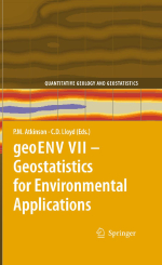
Quantitative geology and geostatistics. Volume 16. geoENV VII – Geostatistics for environmental applications / Количественная геология и геостатистика. Том 16. geoENV VII – Геостатистика для применения в окружающей среде
Proceedings of the seventh European conference on geostatistics for environmental applications / Материалы Седьмой Европейской конференции по геостатистике для применения в окружающей среде
Characterising spatial and temporal variation in environmental properties, generatingmaps from sparse samples, and quantifying uncertainties in the maps, are key concerns across the environmental sciences. The body of tools known as geostatistics offers a powerful means of addressing these and related questions. This volume presents recent research in methodological developments in geostatistics and in a variety of specific environmental application areas including soil science, climatology, pollution, health, wildlife mapping, fisheries and remote sensing, amongst others.
This book contains selected contributions from geoENV VII, the 7th International Conference on Geostatistics for Environmental Applications, held in Southampton, UK, in September 2008. Like previous conferences in the series, the meeting attracted a diversity of researchers from across Europe and further afield. A total of 82 abstracts were submitted to the conference and from these the organisation committee selected 46 papers for oral presentation and 30 for poster presentation.
The chapters contained in the book represent the state-of-the-art in geostatistics for the environmental sciences. The book includes 35 chapters arranged according to their main focus, whether methodological, or in a particular application. All of the chapters included were accepted after review by members of the scientific committee and each chapter was also subject to checks by the editors.
The editors wish to acknowledge the reviewers and the authors of the chapters that make up this book; it would not have existed without their efforts. The editors would also like to thank the sponsors of the conference, who included Cambridge University Press, Wiley, Taylor and Francis, the Ordnance Survey, the GeoData Institute, University of Southampton, School of Geography, University of Southampton and the Remote Sensing and Photogrammetry Society.
Part I Biology
Geostatistical Modelling ofWildlife Populations: A Non-stationary HierarchicalModel for Count Data
Incorporating Survey Data to Improve Space–Time Geostatistical Analysis of King Prawn Catch Rate
Part II Climate
Multivariate Interpolation of Monthly Precipitation Amount in the United Kingdom
Extreme Precipitation Modelling Using Geostatistics and Machine Learning Algorithms
On Geostatistical Analysis of Rainfall Using Data from Boundary Sites
Geostatistics Applied to the City of Porto Urban Climatology
Integrating Meteorological Dynamic Data and Historical Data into a Stochastic Model for Predicting Forest Fires Risk Maps
Part III Health
Using Geostatistical Methods in the Analysis of Public Health Data: The Final Frontier?
Second-Order Analysis of the Spatio-temporal Distribution of Human Campylobacteriosis in Preston, Lancashire
Application of Geostatistics in Cancer Studies
Part IV Hydrology
Blocking Markov Chain Monte Carlo Schemes for Inverse Stochastic Hydrogeological Modeling
Simulation of Fine-Scale Heterogeneity of Meandering River Aquifer Analogues: Comparing Different Approaches
Application of Multiple-Point Geostatistics on Modelling Groundwater Flow and Transport in a Cross-Bedded Aquifer
Part V Pollution
Assessment of the Impact of Pollution by Arsenic in the Vicinity of Panasqueira Mine (Portugal)
Simulation of Continuous Variables at Meander Structures: Application to Contaminated Sediments of a Lagoon
Joint Space–Time Geostatistical Model for Air Quality Surveillance/Monitoring System
GeostatisticalMethods for Polluted Sites Characterization
Geostatistical Mapping of Outfall Plume Dispersion Data Gathered with an Autonomous Underwater Vehicle
Part VI Soils and Agriculture
Change of the A Priori Stochastic Structure in the Conditional Simulation of Transmissivity Fields
Geostatistical Interpolation of Soil Properties in Boom Clay in Flanders
An Examination of Transformation Techniques to Investigate and Interpret Multivariate Geochemical Data Analysis: Tellus Case Study
Shelling in the First World War Increased the Soil Heavy Metal Concentration
A Geostatistical Analysis of Rubber Tree Growth Characteristics and Soil Physical Attributes
Investigating the Potential of Area-to-Area and Area-to-Point Kriging for Defining Management Zones for Precision Farming of Cranberries
Part VII Theory
Estimating the Local Small Support Semivariogram for Use in Super-Resolution Mapping
Modeling Spatial Uncertainty for Locally Uncertain Data
Spatial Interpolation Using Copula-Based Geostatistical Models
Exchanging Uncertainty: Interoperable Geostatistics?
Hierarchical Bayesian Model for Gaussian, Poisson and Ordinal Random Fields
Detection of Optimal Models in Parameter Space with Support VectorMachines
Robust Automatic Mapping Algorithms in a Network Monitoring Scenario
Parallel Geostatistics for Sparse and Dense Datasets
Multiple Point Geostatistical Simulation with Simulated Annealing: Implementation Using Speculative Parallel Computing
Application of Copulas in Geostatistics
Integrating Prior Knowledge and Locally Varying Parameters with Moving-GeoStatistics: Methodology and Application to BathymetricMapping


