Добрый день, Коллеги. Важное сообщение, просьба принять участие. Музей Ферсмана ищет помощь для реставрационных работ в помещении. Подробности по ссылке
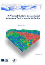
A practical guide to geostatistical mapping of environmental variables / Практическое руководство по геостатистическому картированию переменных окружающей среды
Geostatistics is a subset of statistics specialized in analysis and interpretation of geographically referenced data (Goovaerts, 1997; Webster and Oliver, 2001; Nielsen and Wendroth, 2003). In other words, geostatistics comprises statistical techniques that are adjusted to spatial data. Typical questions of interest to a geostatistician are:
how does a variable vary in space?
what controls its variation in space?
where to locate samples to describe its spatial variability?
how many samples are needed to represent its spatial variability?
what is a value of a variable at some new location?
what is the uncertainty of the estimate?
In the most pragmatic context, geostatistics is an analytical tool for statistical analysis of sampled field data. Today, geostatistics is not only used to analyse point data but also increasingly in combination with various GIS layers: e.g. to explore spatial variation in remote sensing data, to quantify noise in the images and for their filtering (e.g. filling of the voids/missing pixels), to improve generation of DEMs and for their simulations, to optimize spatial sampling, selection of spatial resolution for image data and selection of support size for ground data (Kyriakidis et al., 1999; Atkinson and Quattrochi, 2000). <...>


